Blog

  • Big Meadow Family Campground

    Big Meadow Family Campground

    One thing is true about visiting the Smoky Mountains; there are ample places to stay and this is true of RV parks. Pigeon Forge, Gaitlinburg, and Sevierville are all very well known destination spots in the Smoky Mountains but they were not what we were looking for when we selected our destination.  We were looking for a place close to the Smoky Mountain National Park. We were looking for a place close to fishing and other water activities. We were looking for quiet place to lay our heads after hours of exploring. We found Townsend, Tennessee and Big Meadow Family Campground. Both provided exactly what we wanted and were looking for in a vacation destination.

    Townsend calls themselves the “quieter side of the mountain” and I can attest that after a few trips over to the more popular Smoky Mountain destinations (Pigeon Forge, Gaitlinburg, and Sevierville) it is quieter, less commercial, less touristy, and generally smaller. Big Meadow Family Campground is not the only full service campground in Townsend but it was the right choice for us. From my observations I saw a lot of older couples vacationing with grandchildren, families just like ourselves, and even vacationing couples all enjoying their time at Big Meadow Family Campground. We also noticed that many people at the campground are repeat customers who come back over and over.

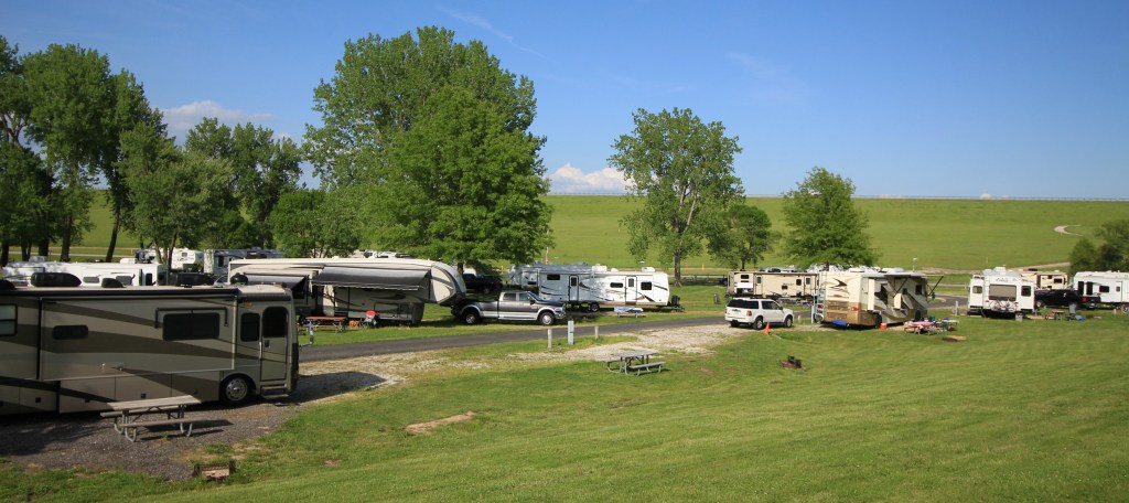
    Big Meadow is a family run business. They have 78 full hook up sites, 25 of these are gravel pads with the rest being concrete, 58 sites are pull through leaving only 20 back in sites. The grounds are beautiful and very well maintained. Security and safety of all guest seemed to be a very high priority of the owners. To enter the park you have to use a key pad to pass though a locked gate.

    During our check-in we were advised that there is a strict 5 mph speed limit in the campground. I can’t begin to tell you how many times we are told about a speed limit and we see people speeding through the campground during our stays but this campground actually enforced the speed limit. I, as a parent with a little girl who has only just recently begun riding a bicycle by herself, really appreciate the safety I felt during our stay at Big Meadow Family Campground.

    DSC02265 alteredThe other rule explained to us at check-in was that the gates locked at midnight and unlocked at 7:00 a.m. This rule impacted us only once. We had planned an early morning departure to drive over to Clingman’s Dome and wanted to leave by 6:30 a.m. The night before we moved our trucks to the front of the campground just outside the locked gate. The morning of our departure we walked a short walk to our trucks and went about our site seeing.

    IMG_7060 alteredThe campground has a splash park, a gazebo with a fire pit, a dog park, and a playground with a large pirate ship climbing structure. The little girls in our group loved playing in the splash park and found it a perfect place to make friends and cool off after our long days of exploring. The only negative thing that I can say about any of these amenities is that the girl’s clothing got stained after a short play on the playground area. I have no idea what they touched but it was a stain that did not come out of their clothing. But to be fair, it is a playground and they are little girls.

    Our campsites were equipped with water, electric (both 30 and 50 amp service) sewer and cable television. The only thing that the sites did not have was a fire ring. Campers could make a fire at their campsite if they had a fire pit and made it on the gravel or concrete (not in the grass).  Other campers during our visit made fires at the fire-pit in the gazebo but we never felt the desire to add extra heat to the already humid temperatures.

    bigmeadow

    We utilized the campground laundry room several times during our stay and found it to be clean and easy to access. In addition to the laundry room members of our group used the men’s shower.  All reports from the shower room were very positive (large, clean, spotless, bug free,  really, really nice were all words used to describe when I asked). We were also invited to a Sunday Morning Church Service held on site at the campground.

    We arrived on a Thursday early evening just ahead of a round of storms, which we could not seem to shake on our trip. Our check-in process went smoothly as we were shown to our  sites, given a list of cable television stations, explained the rules of the campground, and introduced to the family cat, RJ. The rain caught up with us before we could even make it to our site and unhitch. Yet another wet hitch/unhitch.

    We had saved grocery shopping for our week’s stay till we reached Townsend. So, on the first night with little food in our campers and the sky’s dumping inches and inches of rain on us, we sat out to find a local restaurant. We found the Montre Real Mexican Restaurant. The food was good, the staff were friendly and the prices were reasonable. It rained the entire meal  so we said good night and turned in early. The sound of rain falling on the camper sang us to sleep that first night.

    We did use the IGA for our grocery needs. The butcher there was kind enough to special cut some meat for us as they did not have what we were looking for packaged. The store had our basic needs plus a little more but I would say if you are wanting something a little out of the norm you might want to stop at a store in a larger town.

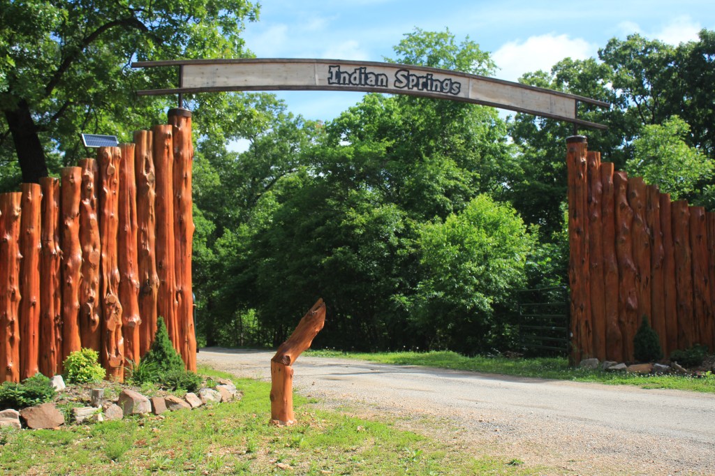
    Smoky Mountain National Park is only a few short minutes from the campground and within fifteen minutes to Cades Cove. We found a back scenic road that connects Cades Cove to Townsend that was a breathtaking and exciting trip to make. (We learned later this road, Rich Mountain Road, is the original route to Cades Cove.)

    IMG_8251 alteredOutside the national park, floating down the Little River is a popular pass time. There are multiple outfitters very close to Big Meadows Family Campground. Two of the outfitters are literally within walking distance to the campground and offer a mile or so float downstream. The water level of the Little River changes frequently so I think any given day the experience can be different. I promise to give you more information on floating the Little River in a later post!

    DSC02287All along 321 highway is a bike path that we used to bike to Burgermaster’s Drive-In for ice cream. Not only was the ice cream amazing (super smooth and creamy) they also had this 1950’s theme.  I learned about “wet nuts.” which is a dessert topping you can add to ice cream that is basically chopped walnuts in maple syrup. Burgermaster may not have had my favorite sundae available (a turtle) but I added wet nuts to my chocolate sundae and it was pretty good!

    IMG_8282 alteredWe partook in wine tasting at Cades Cove Cellars and then stopped into Apple Valley Country Store and Cafe for some shopping and a fried pie. We actually met some fellow Missourians in the parking lot of Apple Valley who were stopping by to grab a few fried pies on their way home to Missouri. We purchased our pies from the store and I wish we had ordered them fresh from the cafe. Next time.

    We also stopped at several other small shops and eateries along the way.  Some of our favorites were: GSM Outfitters, The Boy purchased his first pair of Chacos from them. We were very impressed with the product knowledge and helpfulness of the owners. The local fly shop in Townsend is the Little River Outfitters. If you plan to fish in the Smoky Mountains I highly suggesting going in and talking to them, they have a huge selection of fishing gear and give some great advice . Jake’s on the River is just a cool little retail shop, and PawPaw’s Kajun Kitchen has the best catfish we’ve ever had; and we have had a lot of catfish.

    Keep checking back, we have more reviews and stories to share from our time in the Smoky Mountains.

  • Land Between The Lakes

    Land Between The Lakes

    A few hours south of St. Louis, Missouri and just over an hour north of Nashville, lays a peninsula between two lakes: Kentucky Lake and Lake Barkley. The area between the two rivers is known as Land Between The Lakes and it is a national recreational area.  The location made and ease of access made this a perfect pit-stop on our epic adventure.

    IMG_6911We selected to stay at Hillman Ferry Campground as they have full service sites. We used the online reservation system to reserve our sites as we were traveling near a federal holiday and wanted no surprises. The online reservations were easy to make and eased our concern of finding a full campground. In hindsight, we did not need advanced reservations. We pulled in to find a huge campground with many different loops and lots of vacancies. We learned from talking to locals that the majority of sites are first come first serve and that a small percentage of their campgrounds are reserve-able.  We also learned that each year they hold a lottery to give some people long term access.

    IMG_6897 altered

    We arrived at Land Between The Lakes from the Lake Barkley taking The Trace up to Hillman Ferry. The Trace is a divided highway running north and south and appears to be the main path to get around Land Between The Lakes. The check in process was easy and soon we were on our way to campground number 4.  Our site was a pull through with near a stream with the Todd’s literally right across the road from us. We were surrounded by tall pines and we felt the weight of the humidity.

    IMG_8203 alteredThe morning after we arrived we met a local man who gave me a tour of the park in his golf cart. He told us about some activities to think about participating in during our short time in this area. After breakfast, we loaded up and headed to the visitor center. The staff at the center were helpful in giving us options. Land Between The Lakes has an Elk and Bison Prairie that is a 700 acre prairie restoration project that visitors can drive through and watch out for elk and bison. We were advised to do this activity early in the morning or late in the evening for the best chances of seeing the animals.

    Land Between The Lakes also has a Nature Center where many animals who historically live in this area can be seen. They also have programs and hikes available.  There is also a historical town called Homeplace 1850 which is a working 19th Century farm. In period clothing staff run this farm with task that residents from 1850 would have done; sheep sheering, planting a garden, bringing in the harvest, or even just playing music.

    IMG_6931We selected to visit Golden Pond Planetarium and catch a Night Sky show. While we waited for the show to begin we wondered through the museum of how Land Between The Lakes came to be. The government used imminent domain to claim this land from the people who lived there (not once or twice but actually four different times) until the families who had lived in this area were all removed.

    As we lingered in the museum waiting for the show to start, our phones alerted us to severe weather moving into our area. We realized we had left the awning out on the campers so the men decided to take a quick drive back to the campground to make sure we were secure. By the time they reached the campground a fast moving, intense storm had hit. The campground looked like a battle zone! The stream behind our camper filled, tree limbs were everywhere, and campers suffered damage to awnings. Our own awning was spared as I had grabbed the side of it that morning and lowered one corner. This allowed all the water to run off one side and not pool in the middle.

    IMG_6912

    The mom’s, little girls, and teen boys all attended the Night Sky show at the Planetarium. It was informative and inspired us to star watch the rest of the trip. After the show we rejoined the dads and we did a little geocaching and then headed off to find lunch. By the time we found a restaurant with wifi (one of the teen boys is taking an online college course) we were in the middle of a storm. On our way back to the campground we noticed leaves, limbs, and whole trees scattered all over the roads. We even spied birds perched on trees  drying out their wings.

    birdsdrying

    Upon arriving back to the campground we found that the storm had knocked all power out. The kids took off exploring on bicycles and the adults took off exploring by foot. We enjoyed meeting several other campers as we all bonded over the lack of utilities and how lucky we were to not have received damage in the storm. By the time we finished our walk, we still had no power. We had to make alternative arrangements for dinner because we had planned a crock pot meal that night.

    IMG_6934 alteredA short drive from Land Between The Lakes national recreational area is a small town of Grand River, which is home to Patti’s 1880 Settlement Restaurant. We were able to get late reservations for dinner. While we wondered if our electricity was back on we dined on fried catfish, 2 inch thick pork chops, pasta, bread cooked in a flower pot, and some of the most amazing pie!


    IMG_8217 alteredWe thought our luck had turned with this storm, by the time we got back from dinner the power was on. We went to bed happy to be on vacation and thankful we survived the days storms without any incident. An hour or so after we turned the lights out, Wayne woke me and announced that the power was out again. We went the entire night, temperatures in the high 80’s, oppressive humidity, in a tin can (you may call it a camper) with no air conditioning.

    The next morning we learned the power was out to all of Land Between The Lakes area. This meant not only did we not have electricity to make coffee but we were also could not use water, or dump out tanks down the sewer lines. Despite having had plans to linger for the morning, we packed up and headed out.

    I thought the Land Between the Lakes was beautiful. I wish we had been able to enjoy the swimming area. We never made it to the Elk and Bison Prairie. If we had water toys this might be a spot I would desire to return to. The locals, who were all so very nice to us, love this area and the campgrounds and spend a lot of time camping at Land Between the Lakes.

  • Our 2016 Epic Adventure

    Our 2016 Epic Adventure

    There are moments in my life I wish I had a “do-over” card. Don’t get me wrong, generally speaking I am very content with my life but every summer I do get a little envious of my friends who are teachers or school social workers. Their flexible summer schedule speaks to my soul and seduces it into something that resembles regret. I find myself wishing for a “do-over” so I can spend more time roaming in our RV.

    IMG_8163

    This summer our camping group planned our first ever epic adventure; two weeks on the road traveling. We had planned to leave Kansas City separately and meet up in Land Between The Lakes, Natural Recreational Area in Kentucky. The Taylor family minus The Boy planned to leave Kansas City on July 2 and spend a few days celebrating Independence Day and Pamela’s college best friends birthday. The Todd family and The Boy planned to leave on July 5 after fulfilling work and sports obligations.

    On departure date we were greeted with rain and unseasonably cold weather. Our epic adventure almost got side tracked before it even started when I left my purse behind in a fast food restaurant on the way to our friends home. I think my face went ghostly white when I realized what I had done and how much vacation money I had in that purse. The twenty minutes it took to get back to the restaurant was the longest I have ever held my breath! I was so happy to talk to the manager, who found my purse and safely tucked it in a safe. I got it back with all of it’s contents. Despite the drama of forgetting my purse and the weather, we had a great time on this leg of our vacation. We enjoyed friendship, swimming, boating, tubing, jet skiing, and relaxing.

    On July 5, we got up early and started making our way to Kentucky. Mapquest and Google Maps predicted that we would have a 6 hour 11 minute drive. From Camdeton Missouri we knew the first part of our trip would be down two lane country roads until we reach US Route 60.  Right before we reached Popular Bluff, Missouri we ventured from the paper printed directions to using our GPS Navigation System. We never even noticed that the GPS was leading us away from the printed directions until it was too late.

    IMG_8194

    Our GPS system has three settings: fastest, shortest, and economical. We had it set for fastest. The GPS found every two lane, barely a shoulder path to take us down. We watched our estimated time of arrival go from 6 hours 11 minutes to nearly 10 hours. I don’t think we could ever repeat that trip again, even if we wanted to, but one of the coolest moments was crossing the Mississippi and Ohio Rivers. The Todd’s crossed each of them on their way to Land Between The Lakes but they were hours apart. We crossed them at their intersection point down by Cairo, Illinois. The bridges were a bit scary but the view was amazing; water in every single direction. You barely make it over one bridge before you turn and go over another.

    mississippiohio

    We arrived at Land Between The Lakes National Recreation Area later than expected, tired but thrilled to find The Boy and our camping buddies and excited to begin our adventure.

  • Happy Independence Day

    one year ago we were still in our pop-up camper! So many things have changed in one year.

    Happy Independence Day for us to you!

    image

  • Camp Cooking: Wild Onions and Scrambled Eggs

    Camp Cooking: Wild Onions and Scrambled Eggs

    IMG_6588altered

    I grew up in a family of hunter and gatherers. My father, brothers, uncles, cousins, and grandparents all hunted and fished. I am sure some of it was for fun, or the challenge of getting the “big one” but the truth is we relied heavily on the food they provided to feed us. In addition to bringing home meat from hunting, my father was always bringing home food he had gathered from the wooded areas he visited; berries, wild mushrooms, and wild onions to name a few.

    My mom, being an amazing cook, always seemed to know just what to do with the treats my father brought home (of course I was too young to notice that my dad taught her what to do with all the crazy things he brought home). Every spring, when the morel mushrooms popped from the warming ground, my father would bring home wild onions. My mom would cook them with eggs and serve them to us for breakfast. Or she would serve breakfast food to us for dinner.

    A couple of years ago, The Todd’s invited us to go mushroom hunting in the country. Sadly, we did not find any mushrooms but we did find a large patch of wild onions. Since then, Angie brings me a batch every year. Wild Onions have a flat bright green shoot, as opposed to wild garlic which has a tubular, hollow shoot. They are tender and sweet. They freeze really well, so I always keep a bunch or two tucked away in the freezer so I can enjoy this spring meal any time of the year.

    Breakfast is a big deal when we are camping. Heck, who am I kidding; breakfast is a big deal even when we are not camping. But, breakfast during a camping trip really helps us get our day going and gives us enough energy to go explore and roam. Today’s post is about sharing with you my Wild Onions and Scrambled Eggs dish.


    Happy Eating!

    me

  • Indian Springs Family Resort

    Indian Springs Family Resort

    “Sometimes the most scenic roads in life are the detours you didn’t mean to take.” -Angela Blount

    We never planned to stumble onto Indian Springs Family Resort. We never planned that the state park we were in route to visiting would call and cancel our reservations due to flooding. But they did and as a direct result we stumbled into Indian Springs Family Resort.

    Midwest summers tend to either have too much or too little rain. At the time of visiting Indian Springs Family Resort we were having too much. Everything around us was wet and squishy. The skies threatened every day to open up and provide more but that was not the real threat. Anyone who lives on a river knows that not only do you have to watch what is happening around you, you also have to be aware of what is going on upstream from you.

    IMG_6712

    On Memorial Weekend 2016, upstream was getting a lot of rain and was threatening flooding. When we checked in to Indian Springs, it was obvious the river was at max capacity and the staff told us upfront it was expected to crest by 2:00 a.m. They were diligently watching the conditions and they would let us know if we had to leave quickly.  We kept the trailer hitched to the truck just in case Thankfully we were not flooded out. In fact, the second morning, we got a call that our original destination was back open so we only stayed here one night and moved over to our original destination.

    Indian Springs Family Resort is located in Steelville, MO literally right on the Meramec River.  The new owners, transplanted Texans, took over the ownership/management a few years ago and have been working very hard to bring their vision of a family resort to fruition.  During our impromptu visit, it was easy to see how much work is going into this resort.

    As the name suggest, there are two springs on the property.  The resort has a multi-unit motel, a two-unit cabin with a shared screen porch, a four-unit cabin, a seven-unit cabin, a two bedroom house, as well as tent and RV sites for camping. Currently some of the RV sites are under construction. The sites we were in were all grass and virtually level and needed minimal leveling. The owners were in the process of adding gravel pads to the sites we were in. The RV sites currently only have 30 amp service but I would expect this to be upgraded soon as well.

    IMG_6698

    This resort offers something for everyone. As it is located on the Meramec River there is canoeing, kayaking , or rafting trips  available. The owner of the resort explained to us that all float trips originate upstream and end right at the campground. If the river is not calling your name, you can still enjoy water in the resort pool. Our girls enjoyed splashing around in the spring. There is sand volleyball and hiking available as well.

    The general store has been completely redone and offers your basics. They  even a frozen ice cream case but be warned you might find other things besides ice cream in the case!  Behind the general store is a large area that is unfinished. The owner has plans for a coffee bar and gathering place in the back of the store.

    IMG_6695

    Camping fees at Indian Springs are: adults are $10.00 per person per night with an additional $15.00 per night fee for electricity and water (children under 7 are free but kids ages 8-15 are $5.00 per person per night).

    I like to keep it real here so I want to put out there that this resort has its fair share of negative reviews on the internet. We experienced none of the things I read about. The bathrooms were clean. Our 30 amp service was sufficient. The owners and staff were super nice and honestly bent over backwards to fit us in. This might not be a gem of the Ozarks just yet but we think the potential is there and we look forward to watching this resort, under new ownership, come into it’s own.

    IMG_6700

    We will be forever thankful that Indian Springs took us in on a holiday weekend when we found ourselves without reservations. Our Memorial Day Weekend party of 13 unanimously agreed we would love to come back and do a float trip.


  • Spelunking at Onondaga Cave State Park

    Spelunking at Onondaga Cave State Park

    Occasionally all the parts come together in the right order and the right amounts and make something next to wonderful. Just one little alteration would change the composition and you would have a different outcome. I am not sure how, we certainly experienced more than our fair share of challenges, but our trip to Onondaga Cave State Park came together and will go down in history as one of our most favorite camping trips. We had a steady supply of laughter to balance out the frustration. We were just far enough from home that we felt like we were on a real adventure but close enough to make it home within a few hours. We had just the right mix of friends. We balanced a good dose of adventure out with some rest and relaxation. What more could you ask for in a camping trip?

    Onondaga Cave State Park is located just southeast corner of the central region of Missouri. It is right off I-44 south of St. Louis and North of Rolla. From Kansas City it is 275 miles one way. We first heard about Onondaga Cave State Park from a RV friend, Jenni, who showed us breathtaking photos of Onondaga Cave. The state park has a campground with 68 camping spots (less than 50 with water and electric). We secured our reservations for this trip a long while ago, when most of you were out taking advantage of Black Friday shopping.

    IMG_6854The camping pads were concrete. We had water and electricity for $22.00 a night.  We had sites 61-64 and in our opinion they were the best sites in the entire park. We had a wooded ridge on one side of us and behind our sites was a lovely tree lined creek.  Our girls spent hours splashing in the creek. On the opposite side of the creek was a large greenway that made a perfect dog-walking area. Except the traffic on the road in front of us, it felt like we were secluded in our private area of the campground. IMG_6856There was no cell service in the park but they did have wifi. I will not say it was the best wifi available but we were able to connect and be connected for periods of time.

    IMG_6715 altered

    We have continued to teach ourselves how to geocache and by late Saturday afternoon we were ready to try and find one of the five geocaches located within the park. Out of the thirteen of us only four had even heard about this activity and half of those are still traumatized by the first attempt at geocaching. We set out to find the cache in the park amphitheater. Finding the first cache was challenging but once we found it several members of our group were immediately determined to go out and search for the next cache, even if it meant hiking steep hills and navigating some rocky terrain.  We never did find the second cache but we sure did put in the effort. We talked about that hike for the rest of the weekend!


    IMG_6729altered

    We originally desired to come to this park for one thing: spelunking or the exploration of caves. Missouri has over 6,000 caves and easily earns the title as The Cave State (hum, maybe we should be changing our tag line from The Show Me State to The Cave State).  On our second full day in the park, we made plans to tour both; Cathedral Cave and Onondaga Cave. Due to the size of our group, we were able to arrange group discounts to each cave; bringing the price down to $10.00 per adult for Onondaga and $6.00 per adult for Cathedral. I should mention that if you scoff at the cave tours and desire for something wilder, you can do that at Cathedral Cave. A group called Onondaga Friends Association offers Off Trail Wild Caving  a few times a year to small groups. If this interest you, be prepared to get wet and crawl around in parts of the cave not normally open to the public.I love spelunking but I am going to stick with the organized tours.

    IMG_6754

    Park staff lead flashlight tours of Cathedral Cave on the weekends; the tours require a short 1/3 mile hike to the cave. We had the most amazing tour guide who was informative as well as entertaining. Our guide checked for “critters” before allowing us into the cave; I did not realize at the time she was looking for snakes. Ignorance really is bliss! As we entered the cave, we were ushered into an air lock room, a large concrete room that allowed us to close the door to the outside before opening the door to the cave. This minimizes the amount of air allowed into the cave, therefore protecting the delicate ecosystem of the cave. We were greeted by “locals” in the air lock room; three rather large wolf spiders! Thankfully for us, they were skittish and kept their distance during our short time in the room.


    IMG_6755

    As we climbed the stairs down into the cave, another cave dweller waited to greet us, a cave salamander. Using flashlights, because the cave is not lit, you will see stalagmites, stalactites, columns, soda straws, Stromatolites (fossilized algal beds), and great amounts of cave coral.  We were lucky enough to spot two grotto salamanders in the creek that runs through the cave. Unlike cave salamanders, grotto salamanders never leave the cave. They are born sited and with pigment but as they age, their eyes seal shut and they lose their skin pigment (who needs skin color or eye site in a dark cave?).  By the time they are adults they are blind and colorless almost translucent.


    IMG_6766

    Deep into Cathedral Cave is a Seismic Station that is constantly gathering earthquake measurements and sending them to the Earthquake Center in Colorado.. Right after the Seismic Station, we went down a 65 foot switchback taking us to the curtain the cave is named after Cathedral Curtain.  We traveled approximately 260 feet below the surface during our tour of Cathedral Cave. My overall impressions of this cave is just how big it is. I never felt confined during any part of this tour. During the tour, the guide had us turn our lights off to experience the darkness of the cave. The depth of darkness is beyond any words I can find to describe it. If I had not been touching my daughters shoulders I would never have known she was standing right in front of me.


    IMG_6769

    After touring Cathedral Cave a lunch break was needed. It is down right amazing how hungry you can get hiking around in the Ozarks! I also needed time to recharge my camera battery as I ran out of camera juice in the first thirty minutes of being in the cave.

    IMG_6771

    The entrance to Onondaga Cave is  located at the Visitor Center. Out of the two cave systems in this park, Onondaga is the more visited, more commercial cave. Flashlights are not needed when visiting as the pathways are lit. I also noticed baby strollers on the paths, so I would say there is some accessibility but I also noticed part of the tour the path gets tight and involves a large incline/decline. There is a waiting area for those who do not want to go onto this part of the path, so I would say you could make your own decisions about accessibility. We had a 90 something year old man on our tour (he had previously visited the cave in the early 1940’s when he was a young teen) , walking the entire time.


    IMG_6784

    Just like Cathedral Cave, you have to enter an air lock room before entering the cave. The one at Onondaga is much cleaner than Cathedral (we were not greeted by wolf spiders) and it is equipped with red lights to help our eyes get use to the dimmer light conditions. Onondaga Cave is beautiful, you will still see the same cave features as Cathedral, but our overall impression is we enjoyed our time in Cathedral Cave more so than Onondaga.  Onondaga does have a lost river running through out it. The 90 year old gentleman on our tour told us he remembers his first visit (around 1942) he entered the cave by boat. At times the water seems stagnate but it is in fact running; a former cave owner even built a small waterfall to prove to the public that it was indeed running.


    IMG_6800

    Onondaga Cave has a few mentionable features: The Twins are duo stalagmites, The Rock of Ages, the King’s Canopy, The Queen’s Canopy, and the Big Room. Just in case you wondered we did learn some cave lingo: Stalagmites grow from the ground  and might reach the ceiling one day where Stalactites hang tight from the ceiling. When the two of those meet they create a column. Our favorite mentionable feature of Onondaga Cave was the Lily Pad Room; a room full of speleothems and water.


    IMG_6815
    During our tour of Onondaga Cave, we met a very nice lady from Rhode Island who was visiting Missouri with her husband. Their 21 year old son is currently stationed here and they came to celebrate his 21st birthday with him. We invited them back to our campsite after the cave tour to celebrate his birthday with an adult beverage and ended up getting a great lesson in how to play Bocci Ball from some folks who were really good. It was great to meet new friends while we travel and I do believe we are all addicted to the game of Bocci.
    In a recent study it was found that in the last year campers preferred public campgrounds to private campgrounds two to one (this has increased from the previous year). Onondaga Cave State Park is a perfect example of why state parks are becoming more popular. Besides hiking, visitors to this park can explore two cave systems, or spend their time playing in the Merrimac River either fishing, floating, splashing, or swimming. The camping pads are top notch and you get water and electric for $22.00 a night. If you are needing a summer weekend get away, we would highly recommend giving Onondaga State Park a try.

    Want some more, check out our video!


  • When Roaming With Friends Does Not Go As Planned

    When Roaming With Friends Does Not Go As Planned

    I am a planner. I love to research, organize and generally plan which is a valuable skill/trait to have when organizing camping trips for a group of people.. I would say that most of my planning leads to camping trips that go off as smooth as a babies bottom. However, some times even the best laid plans can be interrupted and we experience moments that are are rocky and full of challenges! Memorial Day Weekend 2016 was one of those types of camping trips.

    Our plan was to travel 275 miles one way from Kansas City to Onondaga Cave State Park in Leasburg, MO with four families, four diesel trucks pulling four campers and thirteen people.  Reservations were made way back in the middle of winter (Black Friday to be exact).  We knew about road construction and made alternative driving plans and secured a meeting spot. We were on our way by 9:30 a.m. Friday, May 27.

    I did not plan to encounter a Non-RV Friendly WalMart:

    Our first pit stop was scheduled for Sedalia, Missouri were we selected the Wal Mart to pit stop at because every RV’er knows that WalMart’s are camper friendly and we could access a variety of restrooms and businesses. What we would never have imagined is that the Wal Mart in Sedalia, Missouri is not  camper friendly.  They have large steel overhead barriers set at 12’6″ over every single entrance which is problematic if your fifth wheel is 13 feet. Imagine if you will: traffic backing up as you have to reverse yourself back under those overhead barriers that you nearly got stuck under. Then, imagine, if you are lucky enough to find the delivery entrance then you are left to maneuver rows of cars, pedestrians in a bustle to shop, or random stop signs strategically placed throughout the parking lot. Note to my future self: when planning a pit stop don’t make the assumption that all WalMart Shopping Centers are camper friendly.

    IMG_6688 altered

    I did not plan for us to be impacted by flooding:

    We stopped for a late lunch in the small town of Freeburg, Missouri. Freeburg is half way between Jefferson City and Rolla on Highway 63. We have been making the same food stop for the past several years because the small cafe has a really big parking lot. Big enough to hold four big trucks pulling four big RV’s and still plenty of room to maneuver.  Shortly after we ordered our food, cell phones began to ring with an automated message from the campground we were heading to:  “The campground closed due to flooding. Our money has been refunded.”

    We were homeless for the night; except we were not. We were driving around with our home on wheels with no place to park them. We we found ourselves trying to finding a place to camp late Friday afternoon on Memorial Day weekend. Thankfully the good folks at the cafe allowed us to connect to wifi and the cell phones went into overtime.  By the end of our meal, we had secured four sites, in the same park, we were no longer homeless!  However, we never shook the threat of flooding, it hung around us all night long. The new RV park, despite granting us refuge, warned us that the Meramec River that ran through the property was swollen to its limits and was threatening to overflow. Which would result in the flooding of the campground.

    I did not plan to find a new hidden gem in the Ozarks:

    Because our plans changed so drastically in such a short time, we were forced to explore outside of our state park comfort zone. We found a potential hidden gem in the making. Indian Springs Family Resort is the type of tucked away quiet place we would like to camp at again and perhaps even enjoy a canoe trip down the Merrimack  River.

    IMG_6712

    I did not plan that we would not be able to enter the park:

    Saturday morning dawned with no more flooding. We also received word that our desired campground had reopened. Excitedly we packed up and set about moving from one location to the next. Our excitement quickly vanished when we arrived at the desired park and learned their main entrance was still flooded and we would have to access the campground via  a secondary entrance. The secondary entrance consisted of a 90 degree turn with a dip between the blacktop and the entrance.

    Lined up we took our turn attempting to make the difficult entry into the park. One camper made it through, the second lost a stabilizer jack, the third camper came inches from bottoming out, and the fourth camper did bottom out on the dip, losing a spare tire. After two attempts from two different directions, it became obvious to all that the fourth RV was not going to enter the park through this secondary entrance.  With the assistance of a park representative, we explored potential solutions. Quickly we eliminated driving through the flood waters that blocked the main entrance (it was estimated to be 5 to 6 feet deep). The only solution left was to drive that huge fifth wheel off the side of the road and through a muddy field, I wish I would have caught that on video! Instead, let me just say, it was a sight to see.

    I did not plan to meet total strangers and invite them to our campsites:

    We had selected Onondaga Cave State Park because we wanted to see the caves and since we were able to get tucked away all nice like in our camping spots, cave exploring is what we wanted to do. The first cave tour we went on required a 1/3 mile hike uphill, an hour long hike inside the cave, and of course a 1/3 mile hike back down the hill. It ended up being too much for one of our friends who gracefully excused themselves for the second tour. That lead us to meeting new friends who were visiting Missouri from Rhode Island. Their son is active duty military stationed here in Missouri and was celebrating his 21st birthday. We had such a great time meeting them that we invited them back to our campsites to have a birthday adult beverage. We never planned to get a private lesson on how to play bocci ball and share many laughs with our new friends.

    I never planned for the trip home to take 9 hours:

    Monday afternoon as we began our travel home, a few of our friends decided to leave early. The rest of us had planned to play on Route 66 a bit before we committed to driving north.  Just about the time we hit Cuba, Missouri and Historic Route 66, the text messages started. One of our friends was broken down along side the road. As we made our way over to him, our other friend texted us to let us know he was also broke down on the side of the road. Both of them were experiencing malfunctions with their turbo’s. When we reached the couple closest to us, Allen was able to diagnose that the induction hose had come off the turbo. He quickly fixed it and we were all three on the road. He called ahead to the friend who was broken down much further down the road and coached him on checking the induction hose. His had fallen off as well. Both vehicles were up and going and we were once again heading northwest towards home. However; the friend traveling with us, kept losing that induction hose and we kept stopping every 11 miles or so. When we reached Jefferson City, we pulled over and unhitched so we could go to an auto parts store for a new clamp. The new clamp did the trick and we were able to make the rest of the way home; going 60 miles an hour so as not to tempt fate.

    I never planned to spend an hour at the Missouri State Highway Patrol Headquarters and locate an old friend:

    The last place we lost the clamp holding the induction valve on was just outside Jefferson City. We pulled into the first place we could find that looked large enough to hold three RV’s and it was the Highway Patrol Headquarters. We camped out in their parking lot for close to an hour. They were so polite. The officers assured us they would rather we be broken down in their parking lot than on the highway. They allowed us use of their bathrooms. They even gave the kids (and maybe adults) a sleeve badge! And….I even found out that a dear friend of mine from college,  whom I have long ago lost contact with,  is stationed at that headquarters!

    IMG_6715 altered

    Sometimes plans do not go as planned. Life is going to throw us curve balls. The best advice I can give you is to go with it, because sometimes life will give you a moment to remember forever, introduce you with a new favorite, create new relationships,  or strengthen old friendships.In the midst of challenging times you can still have a wonderful time.  Memorial Weekened 2016 was just like that for us (full of unplanned events and challenges) but in reflecting back, all thirteen of us agreed, it was an amazing weekend and none of us wanted to leave Onondaga Cave State Park.

  • We Went Geocaching And I Lost My Cool

    We Went Geocaching And I Lost My Cool

    IMG_6595alteredtitle

    The thought of searching for and finding hidden treasure is so exciting; it speaks to the adventurer and maybe even pirate in all of us. A coworker of mine loves Geocaching and her enthusiasm for it made me decide I wanted to try it as well. In my head, I thought my family would love it.

    I downloaded the app Geocaching App by Ground Speak (from my research I learned it is the best app to use) onto my smartphone and thought I was ready. At first glance I was pretty amazed at the number of geocaches around me. They appear to be everywhere!


    IMG_7782 (1)
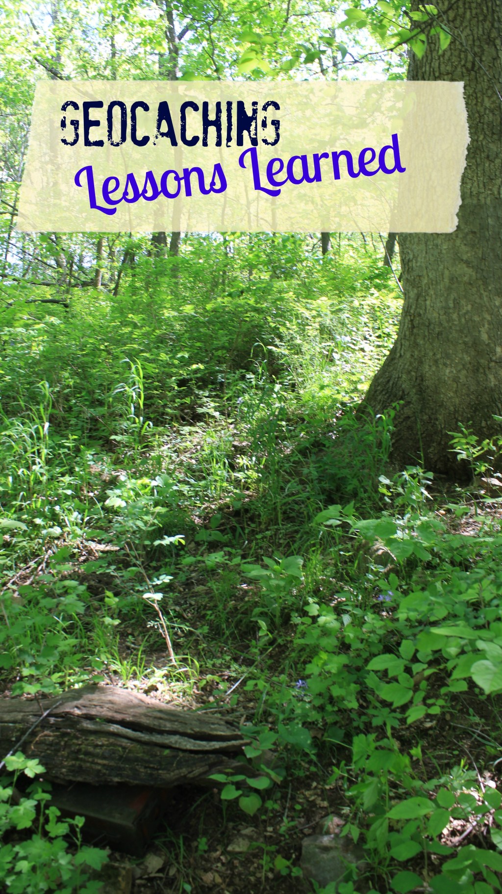
During our last weekend camping trip, I checked the app and found several geocaches close to where we were camping. One of them was only .6 miles away. (I did not realize at the time that was the distance from point A to point B not the distance it would require to find the cache!)  The entire camping party hopped on board and off we went. I should pre-warn you: this is not a happy cheery post about how easy Geocaching was for us. This is the kind of post we will be retelling around the campfire forever.  I can hear it now, “Remember that time Mom lost her nuts while Geocaching?”

    We sure had not gotten far when the shorter people in our group started complaining and wanting to know how far until we found it.  I noticed the app kept counting down: .6 miles became .4 miles and then it went to feet. I thought it was a great idea to keep them motivated by telling them the numbers as they dropped. (What I had no idea was the numbers  went up and down frequently as the trail took us closer and further from the cache!)

    IMG_7783Wayne took the phone from me and actually figured out how to read the directions. I thought we were making great progress so I did not hesitate to take the phone back and continued to read and direct us myself.  At one point we got within 250 feet of the cache. I was so excited as that was the closest we had been but a little disappointed too because I knew that meant to find it we were going to have to leave the trail and hit the woods.  Wayne then speaks up and tells me we were within 100 feet some time back when he was directing us.

    I felt my blood pressure jump to the sky! How could we have been within 100 feet and he not say a thing. He reminded me that he ask if there was any secondary paths. How was I to know that was code for we are super close? Instead we walked a good half mile on and now faced with the notion of backtracking our steps.  Unlike myself, my dear husband has no expectations that things will go smoothly when you start something new. He is always reminding us that it is suppose to be an adventure and adventures often come with challenges.

    Admitting defeat is not something I do easily so I refused to give up! But we also knew that the rest of the crew was completely over this whole treasure hunt. We sent the rest of the crew on giving them a pass to head back to the camper. After waiting a few moments, secretively laughing at my hysteria, they happily headed back to the camper.

    IMG_6597

    Wayne and I began retracing our steps, me yelling the entire way. We never got within 100 feet of the cache but it was within 180 feet. We did have to leave the trail and had to navigate gooseberry branches (they are thorny), a steep hill, rocks, and a dried up creek. The app kept telling us we were close but we were just not seeing it.

    IMG_6596

    Then I stepped in another direction and holy smacks there it was; cleverly hidden, obvious once you saw it, just hanging out waiting for us. I felt triumphant like I had found something valuable!  We did not bring and baubles to trade so we just logged in our find in the log book (even gave credit to those back at camp).  We took photos and then re-hid the cache for the next person. Then Wayne and I gave each other a high five. Apologies for short tempers and bad communication were given freely on the way back to camp.

    IMG_6593

    I learned a few lessons from our first near traumatizing Geocaching outing. First, the distance is misleading. We set out on this trip thinking the Geocache was .6 miles away. That .6 might be as a crow flies, meaning a straight line from Point A to Point B. The truth, we walked over 3 miles.

    Second, the Geocache App has some important information about terrain and difficulty that I either ignored or did not understand on this first trip. The difficulty scale gives insight into how much mental brain power will be needed to find the Geocache. The terrain scales gives insight into how much  physical exertion you will need to find the Geocache.

    I also learned that when you get so close (under 30 feet) of the Geocache you should actually put the phone away and just use your senses to find the hidden prize.  The final lesson I learned is that not every time you seek a Geocache you will find it on the first try. It is okay to walk away not having found it.

    With a success under our belt and having learned a few lessons, we decided to try again. We selected one that was lower on the difficulty and terrain scales.  The kids were with us on this hunt. Again, the short ones got bored easily.  I think if I would have been better about putting the app away when we were within thirty feet and just encouraged them to look, we would have had better success. The Boy found it and proclaimed it super easy.IMG_7784


    Here is the deal; we got a rough start. In the end, we enjoyed it enough that we will not be scared to try it again. I think we will stick with some easy ones to build up our confidence as well as experience. Then we will move into tackling some harder ones!

    me

  • Smith’s Fork Campground

    Smith’s Fork Campground

    Have you ever wondered what it would be like to be the sibling or even first cousin to a famous celebrity? On the surface, you assume it might stink to be in the shadow of someone who is successful and crazy recognizable? Under the surface you may very well find a very successful person in the own right who does not desire the limelight.

    IMG_6603 altered

    This is Smith’s Fork Campground at Smithville Lake. Smithville Lake is a beautiful 7,200 acre lake operated by Clay County that has two different campgrounds that offer stunning lake views just north of Kansas City, MO. . Smith’s Fork Campground is the first cousin to Smithville Lake. It is located below the dam, no lake views, quiet,  no limelight, but yet a wonderful little campground that should not be overlooked.

    IMG_6613 altered

    Smith’s Fork Campground has 79 spacious full service sites; a total steal at $25.00 a night. The reservation system is so easy….it is a quick phone call to the campground host who puts your name down on a list. The campground has 30 and 50 amp service and some sites are fitted with both. a few sites are asphalted, most are gravel. We were in sites 45 and 47, which were both pretty level and needed no level jacks.

    IMG_6606 altered

    The campground is sandwiched on a dead-end road between a sports complex and a city park with a campground and a football field. Near the campground is the dam’s spillway which is a popular spot with locals to fish.  The campground itself does not have a playground for kids but the city park is easily accessible  and about a football field’s distance away.  Just beyond the spillway and the city park, we found a nice hiking trail that lead us on a long hike past a secluded pond.

    IMG_6587
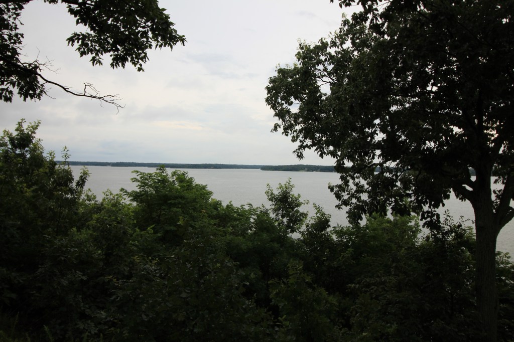
Of course, the lake is a short drive from Smith’s Fork Campground. Smithville Lake has a marina, is great for boating, swimming, hiking or even biking. They have skeet shooting, an RA Airfield, and disc golf.

    During our stay here the weather was beautiful; slightly chilly Friday night and a warm sunny day on Saturday. We enjoyed many guest at our campsite over the weekend. My in-laws joined us Friday for a bon fire and Saturday our good friends brought their family out to the campground for a Mother’s Day dinner.  I think they would become campers if we could just figure out a way for their Prius to pull a camper!