Category: Hiking

  • Falling In Love With Zion National Park

    Falling In Love With Zion National Park

    I started falling in love with Zion National Park through the website Pinterest. I found myself with a pinboard titled “Dream Locations” that I would post random photos of dreamy places I would some day like to visit. Little did my conscious mind realize but the majority of the places I had pinned were all of Zion National Park. The beginning of a romantic relationship had started. I was lusting after red rocks, green trees, and the cool water that had created and defined this small piece of heaven on earth.

    I started sharing my research with my husband. We added names to our vocabulary that never existed before: Angels Landing, The Narrows, and Walter’s Wiggle. We spoke of these places like they held meaning to us. The more research we conducted I found my infatuation deepening. These places crept into our dreams and our dinner conversations. We pondered if we stood at their base could we, would be be able to do them justice?

    It was like puppy love. We had a heightened awareness to Zion National Park. Every photo, every scene on television or the movies, an advertisement in a magazine would cause us to gush and swoon. To say we were attracted was an understatement!

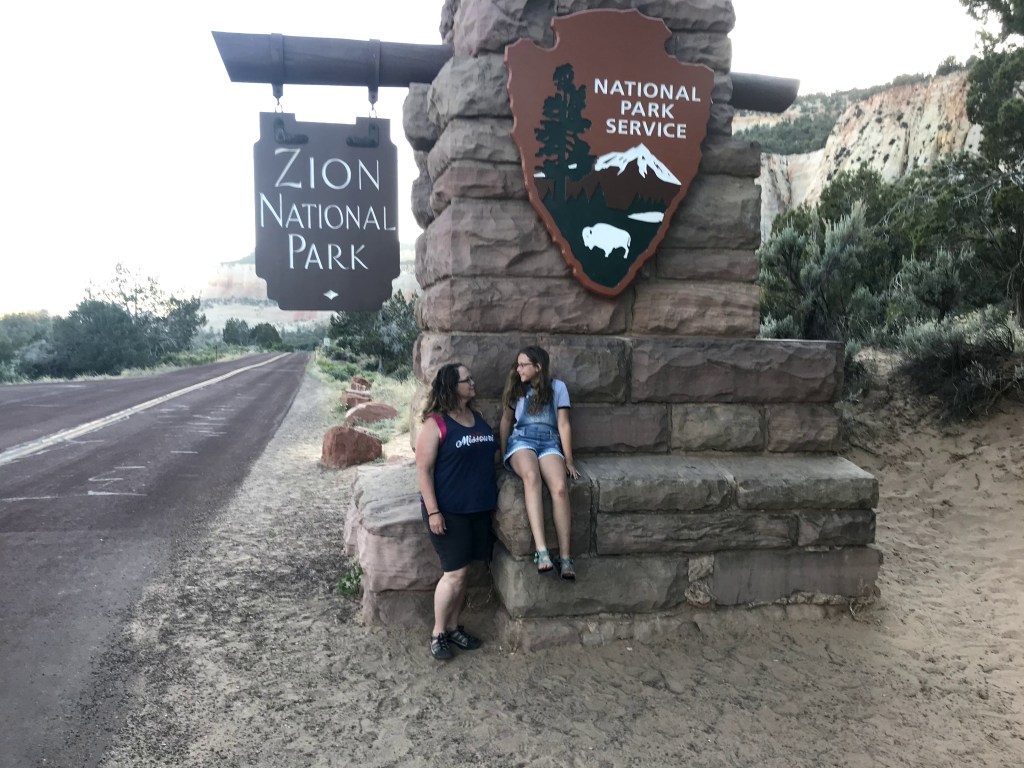
    Our contemplation turned to commitment. We shared our new love with Roxi’s owners (Meeghan and Jeremy) and soon we were planning a three camper trip to Zion National Park.

    We departed Kansas City on May 31, 2018 heading out for a seventeen (17!!!) day road trip. Before we arrived at Zion, we had already visited Great Sand Dunes NP, Mesa Verde NP, Four Corners Monument, Lake Powell National Recreational Area, and the North Rim of the Grand Canyon.

    We arrived at Mt. Carmel RV and Motel on June 8, 2018. We spent three nights and used this park as our base camp for visiting Zion NP and Bryce Canyon NP. We had a 17 mile drive into Zion and a hour drive to Bryce Canyon NP.

    As soon as we arrived and settled, we were off to Zion. We could not wait to get that first site, that first taste of this place that had created such a wanderlust within us.

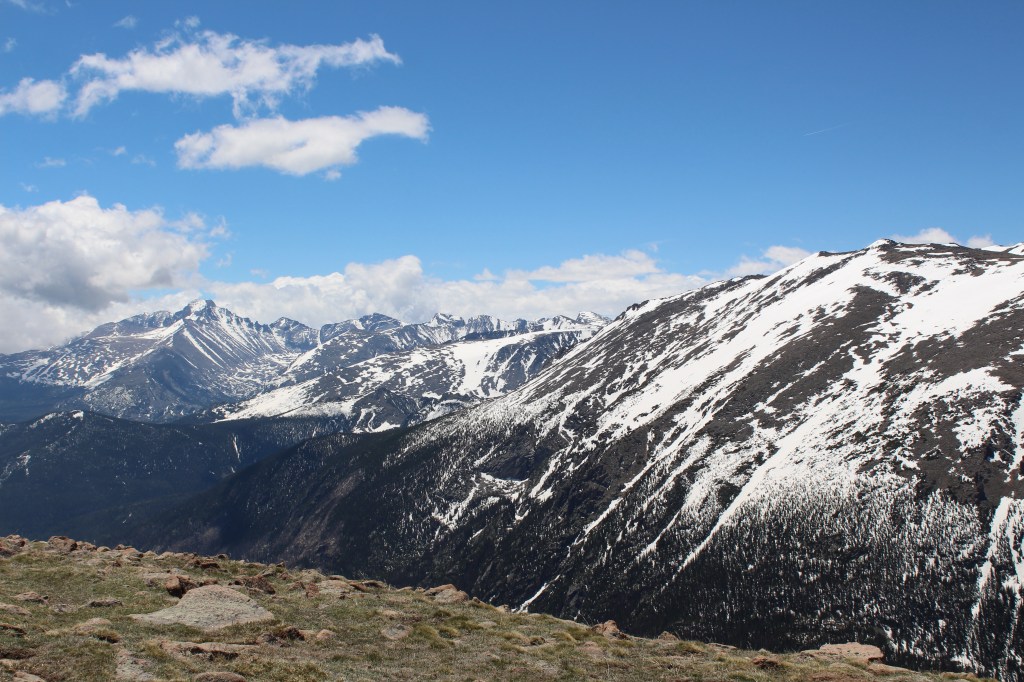
    We arrived late afternoon, greeted by a herd of big horned sheep out looking for dinner. As we wound our way down to the valley floor we kept seeing this large mountain with arches etched into it. It was so red in contrast to the green tree tops it towered over. We made our way through the Zion-Mt Carmel tunnel with awe. Built in the 1920, the tunnel, which is over 1 mile long, is narrow. It was made when vehicles were just smaller. Thankfully the tunnel was only allowing one way traffic which really helped me feel better about taking our large Ram through the tunnel.

    Prior to arriving to Zion, the one negative thing we were aware of and prepared for was the crowds. Zion uses a shuttle service to take guest through the park to minimize the congestion. We knew that long waits to get on a shuttle were possible. So we arrived early armed with full water bottles and an extra shot of patience.


    Our first stop was The Grotto. Our morning goal was to hike Walter’s Wiggle. Walter’s Wiggle is a trail comprised of 20 very tight switchbacks that leads hikers to the entrance to Angel’s Landing, a place called Scout Lookout. The entire hike to Angel’s landing is 5.4 miles roundtrip with an elevation change of nearly 1,500 feet and is estimated to take 4 hours. The trip to Scout Landing is 4.2 miles round trip.

    We had only planned to hike Walters Wiggle but as we encountered other hikers we kept being asking, “You going all the way to Angel’s Landing?” This question became like some sort of test or challenge: Are you strong enough? Are you brave enough? Do you have enough determination and grit to make it to the top?

    Being an overweight, out of shape person, who is more than slightly afraid of heights, I was just going to be proud of myself for making it up Walter’s Wiggle to Scout Landing. But as I hiked, these questions kept running through my head. They were all I could think about as I struggled to find my own breath during the hike.

    Once we landed at Scout Landing, we took a moment to rest. We were happy to find vault toilets at the top as a spacious area to rest in. The sign announcing the start of Angel’s Landing stared at us the entire rest period. There were 8 of us that day on Scout Landing. Eight of us who had successfully hiked Walter’s Wiggle who could turn around and call it a good day. But we asked the question of ourselves that everyone else asked us, “So, are we going to keep going?”

    From Scout Landing to the summit of Angel’s Landing is .6 of a mile but in that short distance you encounter narrow passages, steep inclines and declines, crowded hiking conditions, and very rugged terrain. In the end, five us of, myself included, committed to trying it.

    Within minutes of starting Angel’s Landing, when the first iron chain hold stops, my dear husband tapped out and turned around. He took our shared water with him. We were down to four. And maybe I should describe the four: the youngest was an 8 year old little boy (Tucker) with a lot of spunk. The oldest was that little boy’s 66 year old grandfather (Gary) who had recovered from knee replacement surgery the year prior to this moment. There was also that little boys father (Jeremy) , who is fit as a fiddle, and myself.

    That one mile round trip hike was the hardest thing I have done in my life. It challenged me mentally (fear of heights) and it challenged me physically. Gary hiked right behind me. He kept giving me permission to turn around, then in his next breath would support our next step. He offered me water when I had none. Each step of that hike looked scarier than the last step. But before we knew it, all four of us were arriving at the top of Angel’s Landing.

    We sat near a rock at the top and just collected our thoughts. We took a moment to let that accomplishment sink in. My fear of heights was crazy as I sat there. I was convinced the wind was going to cause me to lose my balance, trip. and roll to my death. I did not trust my knees or my legs. And it shows in every photo taken of me that day.  But I will say this, I have photos to prove that I was at the top of Angel’s Landing. And somewhere deep inside me, I had connected to some inner strength.

    We made our way down, which is just as challenging as the ascent. I trusted my knees and legs to get me up but I seriously questioned them failing me on the way down. But they did not. We maneuvered the crowds, which maybe the trickiest part. When we arrived at the place that my husband left us on, him and the other three greeted each of us with cheers, hugs, high fives, and more water! We were warriors who had returned from battle.

    By the time we were descending Walter’s Wiggle it was starting to get hot. It was also nearing lunch time and we needed to refuel. A short shuttle ride back to the visitor center and we were at our trucks, pulling lunch coolers out, and finding a shady tree to rest under.

    After lunch we took the shuttle to the end of the line,  the Temple of Sinawava to hike the other bucket list hike at Zion, The Narrows. The Narrows is a slot canyon that the Virgin River flows through. The depth of the river varies from ankle depth to waist depth. At certain times of the year, there is a risk of flash flooding that makes the Narrows very dangerous.

    The entire Narrows hike is 9.4 miles from the trailhead, which is by the shuttle stop. After lunch I was pretty pumped for this hike, and I was so hot, I was ready to be walking in the cool water.

    We also anticipated crowds on this hike, and we were not wrong. It was very crowded.  I had heard that the crowds thinned after the first mile (after entering the water) so it was my goal to get beyond that point and just enjoy the environment.

    The three children with us, were so happy to be playing in water. The five adults experienced a large learning curve in how to maneuver the slippery rocks and the cold rushing water. Prior to leaving for this trip, I purchased neoprene socks from Amazon and I found they provided a layer of protection against the cold water. We also had walking sticks that helped steady ourselves as we stepped carefully.

    I knew I was exhausted. Every step was a chore. But I was also convinced to make it past the mile marker. At one point we found a bend and the kids enjoyed splashing. Meeghan and Jeremy decided to stop here and stay with the kids. Wayne and I sat about to keep walking. We took about 20 steps and I just stopped. My body hit the wall and just could not go any further. We had not even gotten a half mile into The Narrows.

    We only spent 1 1/2 days at Zion. Ideally I would have like longer. We opted to not return on our last day in the area because we wanted to explore Bryce Canyon NP. In hindsight I would advise anyone going not to do The Narrows and Angel’s Landing in the same day.

    Every great love story starts with a physical attraction. That pinboard on Pinterest is where my attraction to Zion NP started. Lust can grow into something deeper first attraction and hopefully become an attachment. I can say I am forever attached to Zion National Park. The park and it’s amazing hikes challenged me to a point I don’t let myself experience. I can honestly say I gave my all to that park and in return I was rewarded with amazing views, incredible experiences, and a changed view of my self.

    I know that I am capable of doing difficult things. I know that I am stronger than I think I am. Every time I look over from my office desk and see that photo of my barely standing on the top of Angel’s Landing, I know that I can slay whatever I need to. I climbed Angel’s Landing for goodness sake.


  • Rocky Mountain National Park, Part Two The East Side

    Rocky Mountain National Park, Part Two The East Side

    Hopefully you caught our first post about the west side of Rocky Mountain National Park. This is the second post and it will focus on our visit to the east side of the park. Just to recap, we spent five days enjoying Rocky Mountain National Park in June 2019. We stayed on the west side at a resort called Winding River Resort.

    Traveling between the east and west side you have to use Trail Ridge Road. The road is nearly 50 miles between the Grand Lake Entrance and the Estes Park entrance. Eleven miles of Trail Ridge Road is above the treeline so literally you are on top of the Rocky Mountains as you make the trip from one side to the next.

    We were lucky during our visit that Trail Ridge Road was open. It shut down shortly after our visit due to snow storms. As we traveled the road to and from the east side, the roads still lined with walls of snow taller than our Ram 2500. The snow poles were sticking up serving as indicators for the snow plows to clear the roads. Old Fall River Road, another one way road from east to west RMNP was not open during our visit.

    We stopped at the Alpine Visitor Center on our way over to the east side.  We could not walk to the summit as it was closed due to snow. The views of the mountains from the alpine visitor center are just breathtaking.

    After leaving the Alpine Visitor Center, we stopped and did the short Tundra Communities Trail. This trail is short, only a half mile one way trip. It was snow packed, slippery but we were able to watch marmots when we arrived at Roger Toll Memorial. We were also able to watch a group of people slide down the mountain off in a distance. Sledding down the tundra looked like so much fun until we realized what goes down must come go up. The up looked incredibly hard!

    Near Beaver Meadows Entrance Station we pulled over and found two sets of picnic tables for our lunch. When visiting any national park, we have finally wizened up that bodies in motion need fuel. I can’t not tell you how many times we set off for an adventure to find ourselves under packed for food and water. We were prepared this time. We had ample lunch food and snack food. During lunch we were visited by magpie birds. We have been infatuated by magpies since we were first introduced to them in Yellowstone.

    Next we headed off to the Bear Lake area but first we made a pit stop for some elk viewing. Many people I talk to come to RMNP just to see the elk and I can see why. They are beautiful, large creatures with impressive antlers. During our visit the antlers were still in velvet (which might be my personal favorite time to see them).

    Before we reached Bear Lake, we found a service road that had river access. Wayne and Jackie decided to spend some time fishing. Olivia and I found an area of thick grass carpet next to the babbling river and we just spend the time resting and watching the beautiful white clouds pass us by. I am not sure how but I fell asleep in that spot even knowing we were lounging in areas that animals frequented. I am pretty sure we hiked to the spot from a game trail and not a planned hiking trail. I could also see grass/weeds smooched down indicating the space where a large animal themselves had rested. I am sure you all can tell from my photos that I were corrective eye-wear. A few years ago I invested in some prescription sunglasses. As I slept that afternoon in that sunny warm spot near the river, I lost my prescription glasses. I think they fell out of my pocket. Thankfully, I realized what had happened and the fishermen were agreeable to stop fishing and help me locate my missing glasses. Leave no trace, right?!

    Wayne had been told by the rangers at Kawuneeche Visitor Center that the best fishing in the park at this time of the year would be at Dream Lake and Emerald Lake. Emerald Lake is the fourth lake in a chain of lakes each set about a half mile apart starting with Bear Lake. Both are deep enough that the trout can live through the winter. It just so happened this was also on my list of places to hike so it was easily a win-win.

    Wayne and I at Bear Lake

    When we arrived in the area we quickly assessed how crowded it was. We could not park at the Bear Lake Trailhead so we headed up to Glacier Basin park and ride and we rode the bus to Bear Lake. The first lake in the chain is Bear Lake. It is easy to access, hard packed dirt surface. The hike between Bear Lake and Nymph Lake was no joke. It is short, approximately a half mile but the elevation change was 225 feet. The surface became a little more challenging, rockier and less smooth. the trail was busy. We encountered a lot of people.

    After Nymph Lake, we kept climbing to Dream Lake. The elevation change was 430 feet and we encountered so much snow! The trail was often covered with melting snow so as we would take a step the snow below our foot would give out and we would fall into snow up to our thighs. Poor Olivia was hiking in her Chaco’s and her poor feet were cold! In addition to just how cold and slippery the snow was, we also encountered an entire group of teens on a church trip. They were much faster and more daring that Olivia and I were so they just bolted past you on the trail. The distance between Nymph Lake and Dream Lake was only a half mile but that was the longest half mile!

    We arrived at Dream Lake both cold and wet. Olivia and I sat and enjoyed the beautiful view of the lake and Hallett Peak standing above us (elevation of that peak is 12,713 feet). As Wayne and Jackie fished, Olivia and I just bird watched. No fish were caught at Dream Lake and from there we made a very important decision. We chatted with many hikers returning from Emerald Lake  who told us that the snow covered trail continued. So, Olivia and I made the decision not to hike higher to Emerald Lake. We turned around knowing that the snow would be harder and more slick going down that it had been coming up. So, we found Olivia a sturdy walking stick to use and headed back. Wayne and Jackie caught back up with us right before we reached Bear Lake.  We passed another family headed up between Nymph Lake and Bear Lake and Olivia passed her walking stick along to their daughter. She just looked at her and told her, “Here, you will want to have this very soon!”

    The snow added a layer of intensity to the hike. We were all pretty exhausted by the time we made it back to the truck. We ate our snacks and headed back over to the west side of the park as the afternoon was turning into evening. We were well rewarded with our return to the west side of the mountain by several moose sightings before we reached our campground.

    Nine days after we traveled over Trail Ridge Road, on the first official day of summer, park services had to close the road again due to winter conditions in higher elevations. It was closed for another five days before it reopened. We knew traveling the beginning of June was a gamble but we picked these dates to see the moose. We felt very lucky to have seen moose and traveled across the park using Trail Ridge Road.

    I leave you, with the moose we saw upon our return to the west side of Rocky Mountain National Park. Everything about him, makes me smile and takes my breath away.

  • Rocky Mountain National Park, Part One The West Side

    Rocky Mountain National Park, Part One The West Side

    We have visited numerous national parks and I am always left wondering, “can a person ever spend enough time in such a place of wonder?”

    We spent five days in Rocky Mountain National Park in June 2019. The second longest amount of time we have spent at any national park (Yellowstone remains the longest time we have spent). And I still walk away knowing that we failed to cover so very much. The only saving grace for me is I know Rocky Mountain National Park is a park we can and will easily re-visit.

    East vs. West

    We stayed on the west side of the park at Winding River Resort so the majority of our activities seemed to be on that side. I have no scientific research but it feels to me that the majority of visitors to Rocky Mountain Park enter from the east side, through Estes Park. I know when we went over to the east side it seemed more crowded. I can say that the west side of the park is home to moose and that is the primary reason for our visit. Today’s post is about our experiences on the west side.

    West Side

    We started our time on the west side at the Kawuneeche Visitor Center where we were given advice on hiking trails and fishing. We selected an easy hike, the North Inlet Trail.  Wildlife sightings is what we sought and what we sought advice from the rangers on. Well,  wildlife sightings is what we found. We saw marmot, deer, snakes, and even moose. We hiked the North Inlet Trail about 1 1/2 miles when we noticed how late it was getting to be. Afternoon had left and we were approaching evening when we turned around to hike towards home. We never made it to Cascade Falls (it was another 2 miles further). Our most memorable moment on this trail was when we noticed three bull moose staring down on us from above the trail. We attempted to pass them by walking softly forward. However, the moose had other plans as they started running down the hill straight for the trail. So, we decided to quietly but quickly back up just trying to create as much space as possible. The moose crossed the trail and started feasting on the marsh side of the trail and then the three moose started getting aggressive with each other! We were treated to such an amazing show on our first night but we did decide we had seen too much excitement and quickly maximized the diversion to get out of that area!

    Our second hike on the west side was the East Inlet Trail. My dear friend Harry came to visit us from Denver and after we enjoyed a great lunch at the local Snack Shack we took off hiking to Adams Falls and beyond. The trail to Adams Falls was a bit crowded. A lot of people turned around and returned after the falls but we kept going. We ran into a group of artist painting in a clearing. I have never been an artistic type but those women on that day inspired me to come home and purchase watercolors. I have yet to take them hiking with me but I still think that is in my future.

    We headed to Coyote Valley Trailhead for dual purpose. Wayne and Jackie (who joined us for part of our trip) set out to flyfish while Olivia and I hiked from Coyote Valley Trailhead to Bowen/Baker Trailhead. Olivia and I started off on a defined trail and them we ended up on a different type of trail. Maybe it was a social trail or a game trail? I am not sure but we soon found ourselves wondering through trees, meadows, and crossing the Colorado River four or five different times. As we hiked, the fisherman were working their own way up and down the Colorado River. Olivia and I spied more moose and Wayne and Jackie did catch wild trout.

    Bowen Gulch to Never Summer Wilderness was our final hike on the west side of the park. Never Summer Wilderness is actually not in the national park but it is in the Arapaho National Forest. We hiked the trail toward Parika Lake for a few miles before turning around and heading back. While the environment seemed likely for wild animal sightings we did not have any on this trail.

    Overall, the river was full from spring thaw. The water was running swiftly. Jackie, Wayne, and eventually my cousin Dennis had a great time attempting to catch trout. They had enough luck to consider it a successful trip.

    We started completing and collecting Junior Ranger Badges years ago when we first started visiting national parks. This visit was no different. Olivia completed her program and visited the Kawuneeche Visitor Center to get sworn in. These visits are always fun, the rangers take valuable time away from their other duties to make each child feel special. They each vary slightly based on the rangers individual personality. At Rocky Mountain National Park, the ranger took her own hat off and put it on Olivia’s head! It was a wonderful moment. But as different as each one is, they also share something very similar. They inspire the kids and adults alike to be better, to do better, and to protect more. I am thankful she has not grown out of this.

    The west side of the park met every expectation that we had. We had more moose sightings than I could ever write about. We went hoping to see one moose and came home seeing dozens of moose. In fact, in our feature photo, the one of us in front of the Rocky Mountain National Park sign, a moose was walking out of the trees and walking directly to us. We had one eye on the camera and one on the moose just to see what his next steps were going to be.

    Come back later and check out our east side activities.

  • Mesa Verde National Park

    Mesa Verde National Park

    I love the idea of staying in a National Park. I love the idea of waking up before the park gets busy, grabbing that moment of solitude inside a national treasure, or staying up late to hear the animals and see the dark skies long after the crowds move on for the day. But if I am honest with you; I am spoiled. I love my electrical sites and I love my life more when I have easy access to water. There I said it. So, because of this, I find taking my camper to national parks somewhat challenging. I have a large camper and it does not always fit in the spaces available.

    When we decided to visit Mesa Verde National Park I was most excited to see that they have a small number of full hookup RV sites at Morefield Campground. With early planning, we were able to secure three of the 15 full hookup sites for our visit.

    We arrived at Mesa Verde after a short (less than 4 hour) drive along Colorado Highway 160 from Alamosa. Upon arriving at Mesa Verde our daughter had the experience of actually using her Every Child in the Park pass and taking us to a National Park.

    We spent two nights and roughly three jammed packed days inside the park. We had a nice balance of some relaxing time, some hiking, and some exploring of ancient communities.

    Morefield Campground:

    Staying at Morefield Campground was everything I had always knew staying inside the park would be. It was peaceful, there were breathtaking views, and intimate animal encounters. I felt like we were some place special from the moment we arrived. The sites were spacious and had grass, shrubs, and trees, the exact opposite of what we experienced in Yellowstone at Fishing Bridge.

    IMG_3892

    One funny thing about our site at Mesa Verde, the sewer connection was uphill from our camper. We were a little “worried” because we all know stuff rolls down hill and not uphill. We established a back up plan: use the holding tanks and the dump station at the bottom of the campground.   But since we were only there for two nights, we managed.

    IMG_2414

    Nightly there were Ranger Lead Programs in the campgrounds although we never attended any of these. By the time we reached our campers at the end of the evening, we were worn out and ready for bed.

    Hiking:

    One of my favorite vacation activities is hiking. Mesa Verde National Park has several different hiking options. Their hiking trails seem to be batched by area and there are three different areas: Morefield Campground has three trailheads, Chapin Mesa has four trailheads, and Wetherill Mesa has two trailheads. We elected to hike the Petroglyph Point Trail from the Chapin Mesa area.

    IMG_5277

    The Petroglyph Point Trail is a 2.4 mile loop that takes you past a large petroglyph panel as well as evidence of ancient Pueblo homes.  We found the trail challenging, which was a level of fun for everyone in our group. The age ranges of our group varied from 7 to 65 years old.

    IMG_2429

    Tours:

    Mesa Verde is most known for their Ancient Puebloan cliff dwellings so if you are visiting this national park, planning to visit the dwellings is a very important part of the experience. There are two ways to see the cliff dwellings: a ranger led tour and the self-guided tour. We did a combination of both. We were able to do self-guided tour to see Spruce House, the third largest cliff dwelling and best preserved, from the Chapin Mesa Visitor Center. Currently there are not any tours to Spruce House so seeing it from afar will have to suffice.

    IMG_5261 (1)
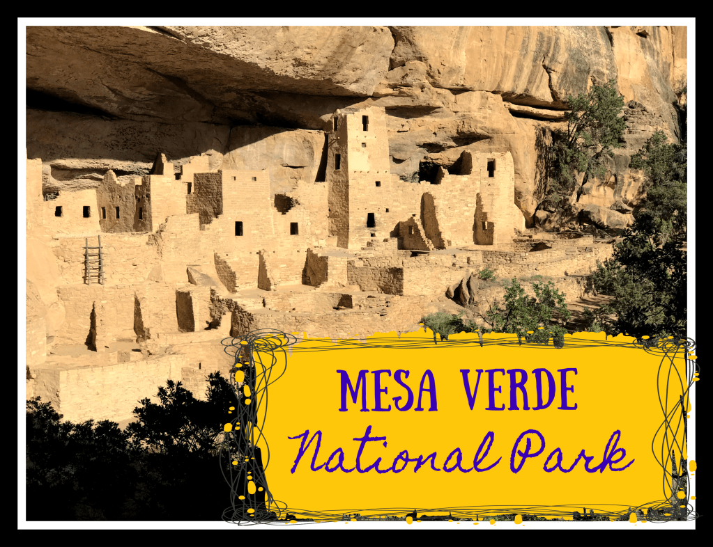
We purchased tickets to tour both the Balcony House and Cliff Palace. Tickets were $5 per person and we purchased our tickets the night before at the ranger station by Morefield Campground.

    I, personally, had a lot of anxiety about taking the two tours and visiting Balcony House and Cliff Palace. The park brochure gave fair warning to visit the dwelling you would climb multiple ladders, of various sizes (8 to 10 feet long, 32 foot long, and up to 60 feet long)  making a verticle ascent of 100 feetup exposed cliff face, crawling through a tiny tunnel, and using a series of stone steps.

    I do not like ladders! Can I even fit into a tiny tunnel? And… what was it about exposed cliff faces? OH MY GOODNESS! I tried very hard not to show it, but these were the questions running through my head all day long.

    IMG_2493

    We toured Balcony House first and as I stood at the base of that large 60 foot ladder my heart pounded. We had to ascend it two by two and I found myself with Meeghan’s husband, Mr. Calm Cool and Collected. The guide told us that we just needed to keep three points of contact with the ladder at all times, which I repeated over and over all the way up the ladder. Maybe I even said it outloud. This is probably why Mr. Calm kept looking at me like “I can’t believe I got paired up with this crazy lady!”

    As freaked out as I was, with as much anxiety as I entered touring these dwellings with, it all melted away. I challenged myself and I felt the growth because of it. Isn’t that what a vacation is about? Stepping outside your normal routine and doing something new. For me, it is and I find that I return from my travels a little stronger than I was before.

    I found out the ladders were super sturdy. They were no were near as wobbly at the ladders we use at home to hang Christmas lights. You know the ones you threaten your children with their lives if they leave the bottom rung while you are on it. (Oh wait, maybe that is just me?) As far as the tunnel, well it was tight, but we all made it, and maybe had fun doing so. The tour guides (park rangers) are pretty specific about not touching the walls of the dwellings as it will leave oils on the rock. So, we did a great job of balancing and I am happy to say, no one fell off the cliff face.

    IMG_3932

    The tours are well attended. They are quick, you only spend about an hour on each tour, but we learned a lot about kiva’s, corn, and the Puebloan people.  It is amazing to see dwellings that have been around for centuries still standing (yes, some of them may have had a little help being rehabbed but who does not need a face lift after a few hundred years).

    IMG_5338

    As we would soon learn, this National Park is alive and exciting but most of that excitement is below the canyon. If you are willing to take a walk, descend down the canyon you are going to see some amazing things.

    Mesa Verde was a joy to visit. We crammed a lot into the three days and two nights we were there. To recap our trip we:

    1. Stayed at Morefield campground
    2. Toured Balcony and Cliff Palace
    3. Obtained Junior Ranger Badges
    4. Hiked the Petroglyph Trail
    5. Learned a lot about Puebloan history and the plants they harvested.

    In case you have been following along, this stop was the third stop on the Betty and Roxy Desert Vacation of 2018.

    Mesa Verde

  • Knob Noster State Park

    Knob Noster State Park

    Every year we have a goal of visiting 5 different Missouri State Parks, which earns us our Missouri Camper Award. Some of those five are parks we visit every single year: Watkins Mill State Park, Weston Bend State Park, and Wallace State Park. But,  we also like to explore and try new things (isn’t that part of the love of RV’ing?) so I also look for a couple of new parks we want to visit.  Knob Noster State Park has been on our list of places to visit for the past couple of years and we finally made it there Memorial Day Weekend 2018.

    Located an hour east of Kansas City in the small town of Knob Noster, we found ourselves arriving just about the time we felt like we left home. Knob Noster is home to Whiteman Air Force Base so by coming here, I really hoped to catch a glimpse of the B-2 Stealth Bomber, which is permanently housed at Whiteman AFB.

    This trip came days before we departed for our two week family vacation, so we were really hoping for a quiet weekend before we sat off on an adventure. As we rarely roam without a friend or two, this weekend was no exception.. Our friends Josh and Vickie and their two children joined us.

    Camp Life:

    The campground loop is long and weaves between completely shaded sites to full exposed to the sun sites. Primitive sites are sprinkled throughout the loop and next to electric sites. There are 70 total sites at Knob Noster SP.

    In addition to the campground, there is also a special use area with two group campgrounds that are available to nonprofits, weddings, family reunions, and other approved groups. One of the parks even has an in-ground swimming pool!

    Each night and day that we were visiting KNSP there were ranger led activities. We attended an owl program Friday night after settling into camp. We attended a ranger led nature walk the next day and on our last evening we attended a ranger led program that discussed the history of the park.

    Interesting History:

    Knob Noster State Park actually started off as part of the National Park Service.  Construction began on the future state park in 1936 as part of the employment relief service and with a goal of turning marginal land no longer suited for agriculture into a recreational area for Kansas Citians and nearby residents.  Ten years later when construction was completed in 1946, the National Park Service transferred control to the Missouri State Board.

    Our Time:

    As we prepared to come to Knob Noster State Park for the first time we heard from many people that the hiking at this park was exceptional. We ended up hiking the Buteo Trail and the Discovery Trail. We found wild plants, animals, cliffs, streams, and lakes. The Buteo Trail has a fun water feature to cross and it takes you around the Buteo Lake. We heard that the Buteo Lake is home to fresh water jellyfish and beavers, but we found no evidence of jelly fish.

    We heard that the town of Knob Noster had a farmers market on Saturday morning. Unfortunately, there were only three vendors at the farmer’s market so we finished in like six minutes. Fortunately, we decided to wander around downtown and found ourselves a few antique shops and a few other cute shops. We even found an ice cream place and Josh proved to everyone that it is never too early in the morning for ice cream!

    One of the evenings during our visit we traveled over to Clear Fork Lake to catch the sunset and do a little bit of fishing. We did not catch any fish but the sunset that night was beautiful! I added returning to Clear Fork Lake to my next time list. I think this place would be beautiful space for an evening picnic.

    Sunday afternoon we welcomed visitors, my brother and niece arrived. One of the small pleasures in life is to enjoy a grilled hot dog and the company of loved ones. As we sat around our campsite, following the shade from spot to the next we actually had a B-2 fly overhead. By the time we heard the noise, the bomber was long gone but man, it was so loud! Maybe next visit we will actually get to see a B-2 fly over. Maybe, but they are stealthy.


  • The Adventures of Betty, Roxie, and The Rockwood: Spearfish Canyon

    The Adventures of Betty, Roxie, and The Rockwood: Spearfish Canyon

    Social Trails. Ever heard of them? They are not formal trails but they are paths that have been made from visitors who learned about them mostly from word of mouth. On our That’s WY vacation, I was first told about social trails from a park ranger as I was trying to find a way of seeing Midway Geyser Basin from a higher elevation. The Park Ranger told me that there were no approved paths but only social trails. He explained that all the social trails leading to where I wanted to go were not safe and that the entire area in Yellowstone had been closed off due to serious injury and even death on the social trail that I was inquiring about.

    Social trails often lead us to hidden gems. Hidden gems can be an out of the way. Not well publicized and generally something only locals know about. Not something you will find in a tour guide or on a map. We all want to find that hidden gem, but we all don’t always have the resources to do so.

    Love it or hate it but social media has changed the game when it comes to hidden gems. Once discovered by word of mouth or from introduction by a person in the know to a newbie, these tucked away secret places are no longer secret. The wide spread use of social media has transformed these hidden gems to trending hot spots. People experience a hidden gem and then post about it and disclose the location. Those post are seen and shared with the hundreds of friends who share it with their hundreds of friends and soon hidden gems are no longer really hidden.

    Heading into the Black Hills, Meeghan learned through social media about a few social trails in Spearfish Canyon that would lead us to some hidden gems. The warning was clear, these hidden gems butted right up next to private property and home owners had little to no patience with the public out hiking to find the once hidden now public site.

    Wanting an adventure, we set out from Rafter J Bar Ranch and made our way north one hour and thirty minutes on Highway 385 North pass Deadwood to Spearfish Canyon. We had no real address, just a general direction as we set about to find a gem called The Devil’s Bathtub. (Side note: why is the Devil in the name of so many cool places?)

    We drove up Highway 385 North from Hill City. The drive to Deadwood was beautiful. We passed Pactola Reservior and nearly pulled over for the day! The water was so blue and inviting. Thankfully, the pull of Spearfish Canyon kept up heading north. Although it was only the beginning of June, Deadwood was already full of bikers. This area is a mecca to the two wheeled community all summer long, so if you are visiting here, watch out for them.

    Just south of Deadwood we got off Highway 385 and took Highway 85 North to I90. We passed another RV park that blew our socks off, so you if you are looking for a place to stay a little further north, closer to Deadwood, Sturgis, or Spearfish Canyon, look at Elkhorn Ridge RV Park.  We took I90 West a few miles and found ourselves at Highway 14A, Spearfish Canyon Scenic Byway.

    Looking up you see tall pine trees and exposed granite rock.  Spearfish Creek runs through the bottom of the canyon. We found our first water fall, Bridal Veil Falls, We were a little nervous that we would overlook the area we were searching for so while we had service we were able to pull up a map and found a road called Cleopatra Place. We knew that Devil’s Bathtub was off this road.

    Parking was very limited and on the day we were there to visit, so many people were playing in Spearfish Creek that most of the available sites were taken. “Private Property” signs were everywhere we looked so we knew we had to be careful in selecting a parking site.

    After a picnic lunch and refilling our water containers, we set off hiking a social trail. There was no map. We followed the trail that crossed and double crossed Squaw Creek up from the floor of the canyon.

    The trail wanders. It is visible in parts and in other parts you make your own trail. It is dry and it is wet. When it is wet, you will find that the water is very cold. At first it feels nice and refreshing considering how hot it is but after extended periods of times in the water, you realize your feet are numb. It is flat and it is rocky. We climbed so many rocks! We were hiking with a wide range of ages (7 to 47) and we all made it. There is shade and there is full sun.

    Sometimes walking in the water is the easiest path. You really can’t make it to Devi’s Bathtub without getting your feet wet. We joked this was a smaller, less glamorous version of The Narrows. This is not a joke: wet rocks are slippery. Ask Meeghan, she went under. Completely under. While holding her Canon. The Canon is fine. But Meeghan got wet.

    Squaw Creek pools. I think there are three or four pools. One of those pools is Devil’s Bathtub. Being newbies, we overshot it and hiked way out of our way. We hiked so far that we no longer had a clear path to follow. So we doubled back and and we finally found the “right” pool.

    The water is deep at Devil’s Pool and it is powerful. We were happy to see a bunch of other hikers hanging around to catch everyone as they came down the natural slide. I have a “thing” with water: we like each other in social circles but we don’t really want to get too familiar with each other. I tried to convince myself during the entire hike in that I was okay to go down the slide. I do believe if that water had been 10 degrees warmer I might have done it. But in the end, I stood by and watched. For those keeping score: Pam’s fear of water: 10,000 Pam overcoming fear of water 23.

    The Boy quickly went down and then took all the littles down. He was having a hayday until he scrapped a rock and came up with a few nasty roadrash marks. Then he was done. Thankfully the dads decided they wanted to go and they each took a little down.

    The hike in took longer than we expected. The hike out was quick and easy. We had planned to hit up a few more “quiet” areas in Spearfish Canyon but time just got away from us and we found ourselves rushing to get back to Rafter J Bar Ranch for dinner.

    We left with mixed emotions, excited at the hike we had found and yet a little sad we had to leave. I can safely say this was the perfect ending to our time in the Black Hills and maybe a favorite of the whole trip. If you are looking for a scenic drive, take Highway 14A through Spearfish Canyon. If you are looking for a moderately difficult hike and like water features, then Devil’s Bathtub Hike is for you.

    I put together a video of our time at Devil’s Bathtub. The video takes you from the bathtub to our vehicles. If you are interested in seeing this social trail/hidden gem take a peak.

  • Campground Review: Arrow Rock State Historic Site

    Campground Review: Arrow Rock State Historic Site

    Arrow Rock State Historical Site

    Arrow Rock, MO

    dates of stay: June 30 – July 4, 2017

    Sites 44 and 45.

    Winter solstice has come and gone and while we may not be able to see it the days are getting longer leading us right back to our favorite season: camping season.  As I sit with my computer covered in my flannel blanket and watch the snow fall out my window, I am reflecting on camping trips of the past.

    This past July we visited a new state park that I think is worthy of visiting again so I thought I would spend some time reminiscing about Arrow Rock State Historic Site.

    I first visited Arrow Rock State Historic Site the summer of 2016 when I started the Centennial Passport. I am not sure what I was expecting the first time I visited Arrow Rock but it certainly was not an entire little town along the Missouri River. The town of Arrow Rock is rich with historical relevance to the westward expansion and the Sante Fe Trail to name a few. And a bonus, this historical site has a beautiful camping loop.

    Arrow Rock is conveniently located just north of Interstate 70 between Marshall MO and Booneville MO. The first observation we made on our trip there was just how quickly we arrived, in fact it took us only an hour and half.  Traveling with us on this trip was the Todd’s but we also had other friends in the campground.

    In our research of Arrow Rock and things we should do while we were there, two things bubble up: J. Huston Tavern and The Lyceum Theatre, J. Huston Tavern is the oldest continuously serving restaurant west of the Mississippi with nearly 200 years of service to the public. Historically this tavern, which started as a family home, boarding house, served meals to traveling settlers and local citizens. Today, it continues to serve two meals a day to travelers and locals. Reservations are highly recommended if you plan to eat at J. Huston Tavern. I tried so hard to get reservations and the wait list was the best I could do.


    Thankfully, my phone rang on the way to Arrow Rock telling us they could fit us in at 6:00 p.m. the night of our arrival. We were so excited!  At dinner time the menu is streamlined; they serve fried chicken and country ham with all the fixings family style. Our meal was delicious!  Everything, from the fried chicken to the potato salad to the mashed potatoes, green beans, corn, and even the buttermilk biscuits, was amazing. We left full and carrying giant to-go boxes.

    Before you leave J. Huston Tavern take a moment to look around. We did not realize the restaurant was more than a restaurant and we did not look around. Later we learned about the restored kitchen and bedrooms upstairs so we had to make a second visit during the crowded lunch service.

    After a large meal, we did a cursory walk around the town. The roads are flanked by cobblestone drainage ditches. Store fronts have boardwalks with large porches that provide shade from the summer son. First impression of the town of Arrow Rock, I felt like I was in the little town that Mark Twain was in when he wrote The Adventures of Tom Sawyer. What I did not know at the time is that in fact in 1973, Arrow Rock was the setting for a Mark Twain musical staring Johnny Whitaker (any other Family Affair fans out there?), Jeff East, and Jodie Foster.

    On our first morning at Arrow Rock we got up early and went for a hike. We found a trail head to the Pierre A Fleche trail was at the end of our campground loop that looked to take us around the entire camping area.  Somehow we managed to get ourselves off the trail. We lost the trail down by the original spring but we took a gamble by climbing a steep bank and found ourselves in the primitive camping loop. It may not have been the trail we were suppose to follow but we had a nice hike and by the time we made it back to the campground we were ready for breakfast.

    Mid-morning we set out with the Todd’s to do a bike tour of Arrow Rock. The campground is less than 1/2 mile to town but the way to town requires biking on the blacktop highway. There was very little traffic and the vehicles we did encounter were very gracious to us.  The entire town is about 8 blocks long and four blocks wide. We followed the self-guided tour. We visited the Shelby Log Cabin, the Masonic Lodge, the Lyceum Theatre, Courthouse, the Calaboose (jail), and the gun shop. We also visited several buildings with historical significance to the black community of Arrow Rock.

    I should note that the Lyceum Theatre comes highly recommended. Each year they host a traveling performers group that preform several Broadway worthy productions at a fraction of the ticket price. When we were visiting Mama Mia was showing but we could not get tickets to the show. The 2018 schedule is out and you can find shows like: Mary Poppins, Crazy for You, Footloose, The 39 Steps, Souvenir, A Comedy of Tenors, Honky Tonk Angels, and A Christmas Carol. If you are planning a trip to Arrow Rock in 2018, or any other year, make sure you plan early and get your tickets to the Lyceum. I will give you an insider tip: J. Huston Taven is open every single day the Lyceum has a performance.

    History lessons are not contained to the city limits. The Arrow Rock Ferry Site is a short hike/drive from downtown. The Sappington Cemetery State Historic Site and  Boone’s Lick State Historic Site are two other historical relevant points of interest very near to Arrow Rock all worthy of day trip visits.   The nearby town of Blackwater is also another great day trip destination during your visit to Arrow Rock. Blackwater is home to the Iron Horse Hotel and Restaurant, the Blackwater Telephone Museum (which was not open during our visit), a Calaboose, several antique shops, beautiful gardens and a train depot.

    Another attraction in nearby Booneville MO is Warm Springs Ranch. Warm Springs Ranch is a breeding facilities for the Budweiser Clydesdale horses. Advance tickets are required and advance planning to get tickets is a must. We were able to secure 6 tickets but on two separate days.  We took the Guided Walking Tour and we were able to talk to the horse handlers, see the harnesses, a 1903 beer wagon, the luxury semi trucks, we watched the grooming of a Clydesdale, and we we able to meet a brand new foal. Tickets cost $14 per person and you will spend 1 1/2 to 2 hours on the ranch.


    We enjoyed our time exploring the town of Arrow Rock and the local community. We also enjoyed our time in the campground. Wayne spent some time fishing in Big Soldier Lake. He successfully caught some bass and tried out his new Whopper Plopper lure. Fishing came to an abrupt end when Wayne lost his fancy lure and my cousin’s lure landed in his finger and had to be cut out.

    When we checked into the park we had the most amazing attentive campground host we have ever had at a state park. The host helped us with recommendations for local activities, fishing, and hiking.The shower houses were the cleanest in any state park we have ever been to. Unfortunately, they left during our stay to move to a new location. The new host arrives on site but were not ready to resume host duties. This caused a delay in cleaning the shower houses as well as there was no ice or firewood. to purchase.

    Our sites at Arrow Rock were huge. They were very long and the mature trees provided great shade. We had lovely neighbors who played the guitar and serenaded me to sleep in the afternoons. I enjoyed it so much I ask them to consider camping with us for the rest of the camping season! When making our reservations, Allen and I carefully selected our sites. Insider tip: this campground is set up to have two campground host but only has one. That leaves one full hookup site to be rented by guest. It is worth it to plan ahead and book this one site if you can.

    Overall, we found this to be a lovely place to visit. We loved the small town and the activities. We loved the sites. Arrow Rock State Historic Site felt like we were visiting a community an that community welcomed us with open arms. They even had a Fourth of July pot luck dinner at the campground the afternoon of the holiday.

  • That’s WY: Yellowstone National Park Lamar Valley

    That’s WY: Yellowstone National Park Lamar Valley

    If there is a place left in our country where the buffalo do roam and the deer and antelope play it is in the northeast corner of Yellowstone National Park in Lamar Valley.  If animal sightings are high on your Yellowstone bucket list then a visit to either Lamar Valley or Hayden Valley are a must.

    The most controversial resident in these two areas is the wolf. Yellowstone re-introduced wolves in 1995 and currently there are eleven packs with an estimated count of 108 wolves living in Yellowstone and nearly 530 in the larger area.  A casual tourist driving through these areas is more likely to find a wolf enthusiast camped out along the road than they are a wolf in the fur.

    In addition to the wolves, many other animals can be seen in these two areas. Pronghorns, elk, coyotes, big horned sheep, moose, bison, bald eagles, osprey, bears, and even badgers. Of course spotting these animals can take a keen eye or you can just follow your intuition. When you see a group of people pulled over looking off in the distance, you can stop and ask what they are looking at. You will find that not only are they eager to share their find with you but they are also likely to share their spotting scope as well.

    Early Bird Gets The Worm

    One morning during our visit to Yellowstone, we sat our alarms and took off as the sun was rising to make the long drive from Fishing Bridge to Lamar Valley. Our children were very grumpy and nearly at melt down stage before we even got started. Thankfully, our efforts were rewarded just a few miles from our campground when we spotted a large 400 + black bear running across the road. We were able to stop, pull off the road, and watch this animal cover a ground like he was Jack Be Nimble. There is nothing like seeing a giant black bear to push away the excitement and change a little persons attitude from grumpy to eager explorer.

    We made a stop by The Petrified Tree as we had heard rumors from other visitors of Moose sightings in that area. We never saw a Moose so we headed off to Lamar Valley.  Shortly after we turned off the grand loop onto Highway 212, I noticed a new animal butt. Wayne thought it was a elk but I had seen my fair share of elk butt’s during this trip and this butt was definitely different. So, we pulled over and set about to explore. Again we were rewarded with a herd of Big Horn Sheep.

    Our animal sightings continued; we found a badger, eagles, and even a momma elk teaching her newborn how to run. We sat and watched this new baby stumble, get up, run, stumble, get up, and run until they were no longer visible. The one animal we had hoped to see but never saw was the Moose.

    Our activity goal in Lamar Valley was to hike to Trout Lake. We found the parking lot to be small and very crowded. The hike from the trail head to the lake is not a long one but has a very challenging vertical rise. We did make it to the lake and again we were rewarded with a beautiful view of mountain peaks reflecting on the lake. We were surprised to find fly fishermen fishing in Trout Lake. Wayne had researched in and thought the lake was off limits to fishing. We learned that only one small part of the lake, the outlet where the trout spawn, was off limits.

    After a good hike and successful animal sightings we allowed ourselves a picnic lunch at the Yellowstone River Picnic area. A very friendly fox made his appearance during our lunch, which allowed us to have great conversations about the side effects of feeding wild animals with the kids.

    People Love Sharing Their Passion; So Don’t Be Afraid to Strike Up a Conversation

    The Todd’s loved Lamar Valley, in fact it was probably one of their favorite places in Yellowstone. They also had great animal sightings and were lucky enough to see the Moose near the Petrified Tree. The Todd’s learned that the visitors camped along the road are serious about their animal sighting and they are eager to share their passion with others.

    Despite an early start to our day and despite the distance between our campground and Lamar Valley, we decided to return to Lamar Valley that evening in hopes of spotting a few more animals on our bucket list.


    Off Highway 212, is a dirt road leading to Slough Creek. We traveled down that road and found a large group of wolf enthusiast camped out with powerful spotting scopes. We also learned they were watching a wolf den about 2 miles west of where we were standing. Waiting to see these animals is part of the game. These wolf enthusiast are prepared to wait Our little girls on the other hand find boredom really quickly.  In an attempt to distract, Wayne took the girls for a hike down to Slough Creek. Funny, on their hike, they disturbed a coyote who then walked right in front of the wolf enthusiast and they barely saw it. They were looking two miles past that ole coyote.

    Our binoculars were not sufficient and we were thankful our host invited us to use their spotting scopes. Having poor eye site and needing corrective lenses I had little hope that I would be able to maneuver my glasses and the scope and be successful in seeing anything. Our host were so gracious and kept letting me try. I had probably tried three or four times and never saw a thing. I felt so inadequate because everyone else who looked through that scope got so excited. Not me. I could make out from where we were standing the den, or the general area but we were so far away and things just looked liked dots. Then, our host patiently offered me one more look and I was able to see the den and the wolf pups playing outside of it. I felt such a sense of mastery when I was able to figure out how to use that scope and got to see those pups (that looked just like dogs by the way).

    Persistence Pays Off So Don’t Stop Believing

    As much as Allen wanted to see the wolves, I wanted to see a Moose. Rumors haunted me all day of a momma Moose and her baby being spotted along Soda Butte Creek north of Soda Butte Cone. We decided to part ways with the wolf enthusiast to go in search of a Moose. As we traveled Northeast on 212 every finger was crossed that we would be lucky. We kept hearing the momma and her baby lingered in the creek so I kept following the river. It went from wide and slow to narrow and rushing.

    We finally turned a corner, the river changed again and we saw all the people lined up along the road. There was a Moose off in the distance eating. I think I slide out of the truck before Wayne even had it stopped. Before I could blink, Angie and the kids were right there. We sat and watched her for a long time and then without warning her baby emerged from the brush. A collective “awww” rose from the small crowd who had gathered. I was so excited I sat in utter amazement forgetting to take photographs!

    The Icing On The Cake Is So SWEET

    We left Lamar Valley to head back to camp with our head and hearts happy. What a day! We started off with a bear, then big horned sheep, then a badger, an eagle, a fox, wolves, and finally a moose. My Yellowstone Vacation was officially complete. We decided to stop by Tower Falls.

    However, before we could get to Tower Falls, traffic stopped and began backing up. This is usually a really good indicator of an animal sighting. However, the only animal we could see was a bison, which are so plentiful you honestly stop stopping for them after your first day in the park. Before we could even process that this crowd was forming for a bison, we saw a momma bear and three cubs frolicking in the trees near the bison. The bison moved forward and spooked the bears and up the trees they scampered. No wonder all these people had stopped. The show was amazing. The bison eventually moved along (crossing the road right between The Todd’s and us) and the bears headed for higher ground.

    We ended our perfect day by stopping by Tower Falls.


  • That’s WY: Hiking Beaver Ponds Trail

    That’s WY: Hiking Beaver Ponds Trail

    In planning for our time in Yellowstone we knew we wanted to do a lot of hiking. But, how do you plan for a hike?  Yellowstone has over 900 miles of hiking trails and that felt a little overwhelming. What things do you take into consideration when deciding what hike to take:  wildlife? difficulty? distance? These were all things we took into consideration while planning out our hikes while in Yellowstone.  We had researched areas  of interest prior to our trip as well as used Chimani’s Yellowstone National Park app. In the hiking section of this app it provides trail information – the scenery, the trail’s distance, approximate time the trail will take and the difficulty.

    My husband has been an avid trapper his entire adulthood. One animal he has trapped is the beaver. The Chimani app indicated that Beaver Ponds Trail was a great place to see a number of beaver ponds, sharpened and chewed logs, and maybe even a beaver if our timing was right. The hike was approximately 4.5 miles and should take only 2 hours. The app also indicated it was a moderate hike but we felt like the distance and time frame was something the kids could handle.

    Beaver Pond trail is located in the Mammoth Area. We asked a Ranger where this was located and after giving us directions they also mentioned that a mama grizzly and her 2 cubs have been spotted in this trail. The Ranger immediately asked if we had Bear Spray and if we were traveling in a group. As I was trying to process this new information and the actual odds we would see a bear, my very caution husband immediately became hesitant.  He knew that seeing a bear up close would cause myself and our daughter to freak out. His initial reaction was that we would find another trail to hike.

    As much as I love this cautious side of him I was disappointed that he was saying no. I really wanted to do this hike with the hopes of seeing beaver and dams. I was also a bit disappointed in not seeing a bear. So Pam and I went investigating for more information on the safety of traveling this hike where bears had been spotted. We spoke with another ranger and asked additional questions – she said hiking on trails with bears is common. She strongly encouraged taking Bear Spray, traveling in a group and making noise. We could accommodate all of these and with the excitement of seeing a potential bear and of course the beaver on this hike we set off.  The Ranger also gave us one last piece of advice: to do the hike in reverse. She felt we would be closer to the beaver ponds if we started where most people ended.

    It did not take long for us to start seeing wildlife; within minutes of starting this trail we saw a female elk on the hill. Being so close was awesome and the elk did not even seem to be phased by our presence.  This felt like a positive sign that we would see things on this hike. This trail traveled up hill with several switchbacks throughout the timber.

    I have never been on a hike like this one. It was steep and we were huffing and puffing quickly. The kids were troopers! The amount of complaining at this point in the hike was minimal. It was the afternoon and temperature was on the warmer side but there was plenty of shade to take breaks under. Everyone had water and we took our time. During the hike we talked, laughed, sang songs and played games. Some may say I have a “loud” personality and I used it to the fullest during this hike.  I was doing what I could to keep those bears at a distance! Pam kept joking that we had no worries of sneaking up on anything because we have “a Meeghan” to make all the noise needed to for our hikes. I do wonder, was she joking?

    We continued through timber still not seeing any ponds or signs of beavers. We kept thinking it has to be coming up soon, right? This actually wasn’t the case at all. We did find ourselves walking through fields of sage brush, snow capped mountains in the distance, and smaller foothills all around. The thought of encountering bears was ever present in our minds. We had encountered a family of four traveling opposite direction of us. They informed us they had indeed seen the momma grizzly and her two cubs not long before. It seemed as if the odds of us encountering bears on our quest to see beavers was growing.

    About 3.5 miles in, we came upon two rangers on horseback. They had been out removing downed trees from the trail and were happy to chat with us. By this time, we had a few questions: had they seen the bears, where were the beaver ponds, and could they hear us coming. The Park Ranger assured us that we were on course for the Beaver Ponds and he also told us the bears, a Mamma Grizzly and two cubs, one black and one cinnamon, were off the trail about 100 yards ahead of us. He gave us some pointers on how to navigate the trail and when to expect seeing the bears. Not wanting to surprise the bears on the trail, As precaution, I once again went over the bear safety check list with the rangers, bear spray, check, hiking in a group check, and make noise as to no surprise the bears. They replied, Check!! You’ll ain’t sneaking up on ANYTHING!  They laughed and said they could hear us coming a mile away. We left the Rangers as they headed back to Fort Yellowstone. They did not seem concerned about us traveling on this hike in any way and that made us feel even more confident about our ever increasing odds of encountering a the mamma grizzly and her two cubs.

    The Rangers had warned us about a boggy area in the trail and told us to veer left at the fork in the trial. They had last spotted the bears in a field just past the bog to the south of the trail about 100 yards or so in a field. Wayne and Jeremy took point as we continued down the trail. The terrain changed from grassy and rocky into more of a forested area, As we came upon the wet boggy area we spotted the fork in the trail. As we approached, we saw the black colored cub about 30 yards in front of us, in the middle of the left fork, right where the ranger had told us to go. Immediately, we seemed to have forgotten the bear safety rules and instead of making noise Jeremy, the cautious one, held his hand up like he does when hunting and pointed ahead. As the trail leaders hushed the pack of hikers, Wayne signaled for the big guns aka Pam and her Cannon Rebel to come the front of the column, Ironically, Pam’s SD card was full and she barely got any photos of the bears!


    That’s when we spotted the cinnamon colored cub rambling up to his sibling. That was about the time we realized Mamma Grizzly was no where to be seen, Panic was started to set in as everyone grabbed for their bear spray, Mamma Grizzly popped into view out of the timber just beyond her cubs.

    Mamma bear crossed the trail in front of us and her 2 cubs followed.  It seemed like they were oblivious to us being there. Mamma bear traveled up the hill to the left of us and found a nice shady spot to lay down. It appeared she fell asleep within minutes of sitting down. The bear cubs stayed down in front of us about 50 feet away from mom and continued to play with one another and climbing trees. We all could have stood there and watched them for a long time but we moved on to make sure we didn’t make the bears feel pressured. It was so exciting!

    Spotting the bear boosted everyone’s morale. We realized seeing animals in the wild could be a rewarding experience as long as we respected the animal and their space. We got a shot of adrenaline that we desperately needed to continue on. The Rangers had indicated we were getting close to the ponds so we pushed on hopeful to see beaver.

    We finally came upon the first of a series of ponds. The first one was pretty boggy. We had to maneuver around water and mud. Unfortunately as we moved through all three ponds, we never saw a beaver. In fact, we never saw any signs of beavers. We got excited at one point at a log jam but realized it was caused from rushing water and not beaver. We had found the ponds but no beaver and no signs of any beaver.  The beavers had moved through there years ago. All that was was three empty ponds.

    Not seeing ANY signs of beaver was disappointing but the other wildlife we saw up close on this hike was amazing something that made this hike well worth it. The changes in terrain were also quite amazing but as the hike continued we also realized we were still very far from the end. We also noticed changes to the weather. Clouds moved in, the skies began to darken, and the temperature dropped. We really started booking it. This is the point where the complaining really began. Motivation became the ice cream treat we would have at the end. We ended up hiking between 6-7 miles total. The actual Beaver Pond trail head didn’t start until until about 2 miles in which is why this made the hike so long.

    So a couple things to note while hiking in Yellowstone-

    • Make sure you actually know the specific distance of the trail and where it begins and ends. We hiked 2-3 miles before we even reached the trail head;
    • When hiking in bear country make sure you hike in a group,  have bear spray, and have a “Meeghan” to make noise while you hike;
    • there is no shame in bribing your children through a hike. Besides once they had ice cream in hand they forgot all about the hike;
    • And lastly, there are NO beaver on Beaver Pond Trail


    Good Luck and Happy Hiking!

    Meeghan


  • That’s WY: Yellowstone National Park Mammoth Hot Springs Area

    That’s WY: Yellowstone National Park Mammoth Hot Springs Area

    Way up in the north west corner of Yellowstone National Park is the Mammoth Hot Springs area. Due to road construction on the western part of the grand loop during our visit, it took us nearly two hours to travel up to Mammoth from Fishing Bridge RV Park.  Knowing the time commitment it would take to get up there and back, we decided to make an entire day trip of our visit to this area.

    Mammoth is one of those areas in Yellowstone full of geological oddities. The air has a distinctive aroma of sulfur aka rotten eggs. I remember when I was a young kid and experienced this for the first time. My brother and I sat in the back of our car gagging together. Now, our children have experienced this aroma. The Short Chic has such a powerful gag reflex and spent the majority of our time around the Upper and Lower Mammoth Terraces gagging or at least tying not to gag.

    Here is a summary of our day in the Mammoth Hot Springs Area.

    Roaring Mountain

    I don’t think this is an actual mountain but it is a cool thermal feature. Roaring Mountain seemed about half way from Fishing Bridge to Mammoth and we thought it would be a great place to stretch our legs and use the restroom. We never found the restroom but we did enjoy seeing the entire hill smoke from the fumaroles,  The area looked like a  World War II battle field: the entire hill covered in smoke rising from craters in the ground, charred dead trees, and no live vegetation to be seen.

    Upper and Lower Mammoth Terraces

    I heard once that the travertine terraces at Mammoth were the inspiration for Superman’s home planet in the 1978 Superman movie with Christopher Reeve. I have no idea if that is true as I could find no reference to it on the intranet. But, even if it is urban legend and has no truth, I can’t help but think how this part of Yellowstone feels like it belongs to another planet.

    The landscape here is full of chalky white terraces tinged with canary yellow, green, orange, pink, or even the color of rust.  As you walk the boardwalks around the terraces you will encounter what many have described as the inside of a cave turned out. Hot water seeps to the surface releasing calcium carbonate that forms these terraces  that seem to melt into each other. The boardwalks near the terraces are rather crowded at all times with tourist but they are occasionally visited by some of the four-legged Yellowstone residents.

    Mammoth Upper Terrace Drive

    There literally is something for everyone in Yellowstone National Park. If you want to hike, they have easy as well as challenging hikes. If you want to see thermal features you can. If you want to see mountains or valleys they are there. If you are a do-er; there is plenty to do. But if you are a see’er; there is plenty to be seen. There are scenic drives all over the park. Some are lengthy and some are short. Mammoth Upper Terrace Drive is a two mile loop that goes behind the upper terraces.

    Fort Yellowstone

    For over three decades the US Military protected and served Yellowstone National Park. During that time, Fort Yellowstone was built. Numerous buildings remained although they have been re-purposed and no longer serve the US Military. Ironically, the buildings, cream to light yellow painted wood, or brick, some with red roofs sitting on perfectly manicured lawns bring to mind a summer resort. Which is pretty ironic because that is what it has morphed into. It is not uncommon to see bison or elk strolling along or napping in the fresh grass in Fort Yellowstone. During our visit an elk cow had even hid her newborn calf under a wooden porch of one of the remaining houses. She lingered nearby on high alert to run off any tourist that got too close to her baby.

    Animal sightings in Yellowstone are mostly lucky timing; you have to be in the right place at the right time and be observant enough to catch it. As we prepared to go hiking north of Mammoth, we were “lucky” enough to watch a scene straight out of “When Animals Attack”.  In between two buildings was a lawn full of Uinta Ground Squirrels making all kinds of noises. Besides the noise they were scampering from one place to the next. It took us a moment to figure out that a Magpie bird had swooped down and was attacking a ground squirrel. The other Uinta’s were doing their best to distract the Magpie. We stood watching the battle for survival between the Uinta Ground Squirrels and the Magpie. This day, the Magpie won. I know this survival battle was small but large or small they happen all the time in the wild, We felt amazed to have witnessed it. We felt bewildered that it all happened in the middle of Fort Yellowstone as hundreds of tourist walked determined to catch a site by without recognizing what has happening right there on a well manicured lawn.

    We visited the Fort Yellowstone Post Office to mail our post cards home. We walked past the Hotel Dining Hall. We visited the Park Ranger Station and even crashed a Ranger led private outdoor school lesson.

    Roosevelt Arch/Northern Entrance

    The Roosevelt Arch is about as iconic as other well known sites in Yellowstone (Grand Canyon of Yellowstone and Old Faithful).  The Arch stands proudly at the original entrance to the park, which is currently known as the North Entrance. This entrance is a short drive north of Mammoth following the Gardiner River and I should note is the only entrance open year round.  Visitors who start here or those like us who make their way here will also want to visit the small town of Gardiner, Montana. We spent time in the Forever Yellowstone store, relaxing in the wooden rocking chairs outside the store. In fact, The Boy got so relaxed he did not feel his wallet fall out of his pocket. We ended up making 2 trips to Gardiner just so we could rescue the wallet.

    On our way back into the park, the Masters family and the Taylor family got separated by the check in lines. The Taylor’s took the opportunity to pull over and watch a Pronghorn. The Pronghorn had enough paparazzi just about the time the Masters caught up. We started screaming at them to watch out for the Pronghorn, who was barreling right toward their truck. Thankfully, Jeremy was able to avoid hitting the animal but I will say, it was close enough that we walked away with a memory and wondering how many animals die each year by being hit by an automobile.

    Gardiner River

    We knew we would be out exploring the park every day and picnic lunches were going to be our lifeline to maintaining energy. Our only challenge was finding a spot worthy of our daily picnic. On our way back to Mammoth from Gardiner we found a pullover next to the Gardiner River. It was loud from the rushing water but it was peaceful and we had a lunch view that we just don’t get at home.

    Hiking Back Country

    We were in Mammoth on our second day in the park and we had the opportunity to take our second hike. We were warned when we came back through the entrance from Gardiner to Mammoth that there was bear activity on the trail we had chosen to take (Beaver Ponds Trail) but we did not allow that to deter us. There are two truths I have come to believe about hiking in Yellowstone. The first truth is wild animals live here and it is a possibility that you can encounter them. I guess you have two options, be prepared for that encounter or be surprised by it. We chose the first option and really enjoyed our experience.

    The second truth I have come to believe is that once you get on that trail and you leave behind the boardwalk, you honestly leave behind crowds. As we hiked away from Mammoth Hot Springs it felt like we were alone but in reality we were less than five miles from the crowds. Being alone (or in a small group) made me feel small. In every direction was this huge vast wilderness and I just stood in awe of it.

    Ice Cream

    It is not by chance that I have put ice cream on this list in the last spot. Let’s just say simply that bribing children with ice cream is a powerful motivator. Even when you are in the middle of a multi-mile challenging hike. So, on our second day in Yellowstone National Park, we began our vacation love affair with ice cream.  We had heard about the Huckleberry Ice Cream in the park and really wanted to give it a try. After our hike we stumbled into the ice cream shop in Fort Yellowstone and ordered up a round of ice cream for all. I ordered the Huckleberry flavored and was a little disappointed to find out that Huckleberries are actually very expensive and the ice cream was really more blueberry with a little Huckleberry flavoring.

    Packing a lot into a vacation day might be what we do the best. We hit it hard on our second day in Yellowstone and it was a long day. To some that may not be a good thing but I think we created a balance between seeing/doing, riding/hiking, and odd/beautiful. I love the Mammoth area. It brings back childhood memories for me and I treasure those. My first visit to Yellowstone with my family was when I was a young teenager. We stayed in Mammoth Campground in the very last camping spot left in the park. We were so ill prepared! That trip and that camping experience has remained with me all these years. I can only hope that this trip remains with my own children all their years.


    Are you ready to go on an adventure together?


    Pamela